HYDROGRAPHIC
SURVEY
LandScope Engineering specialises in high order inshore and nearshore hydrographic surveys. The combination of our experienced team of hydrographic surveyors, a versatile fleet of survey vessels, and the latest survey equipment ensures that programmes are designed for maximum efficiency whilst not compromising on data quality or personnel safety.
All our hydrographic surveying benefits from a bespoke design in accordance with IHO Standards for Hydrographic Survey (SP44). The accuracy, safeguarding, and treatment of hydrographic data is diligently managed throughout the life-cycle of our customers’ projects. With employment of sophisticated delivery, viewing, and serving technologies we ensure maximum value is derived from survey investment.


DEDICATED AND FLEXIBLE SURVEY PLATFORM
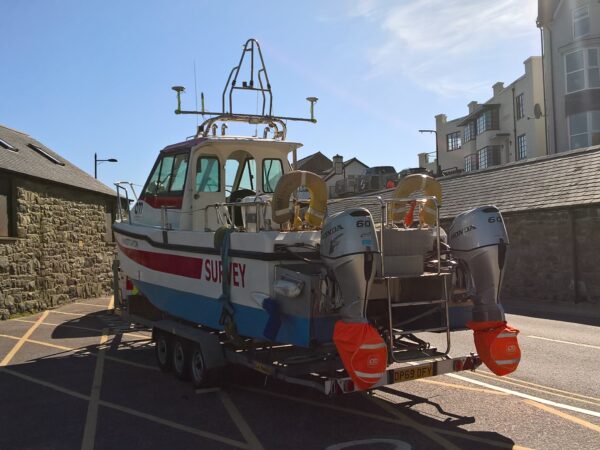
Our survey vessel fleet is road transportable to facilitate a rapid response and cost-effective hydrographic surveying solution. S.V. “Investigator” is MCA coded for operation up to 20 miles offshore and is permanently fitted with high resolution multibeam, scanning sonar and mobile mapping systems. Geophysical sensors are configured as specific survey projects require.
Our hydrographic survey vessels benefit from a detailed laser scanning dimensional control survey to ensure all X, Y, Z offsets are accurately modelled.
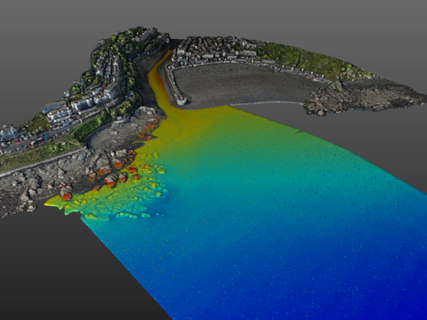
BATHYMETRIC SURVEY
LandScope Engineering has over 30 years of experience undertaking multibeam bathymetric surveys within all environments, from small rivers and lakes to estuaries and coastal waters.
Our in-house experience and expertise, and investment in the latest survey platforms, systems and software packages, allows us to offer multibeam bathymetric resolution and accuracy to IHO specification in all environments, from river intakes, reservoirs, navigable rivers and canals, through to near-shore and coastal environments.
With experience from working in all marine environments, we are highly confident in our ability to deploy the most appropriate vessel and survey resources for your project, which distinguishes us from other hydrographic survey companies.
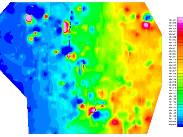
GEOPHYSICAL SURVEY
With application of the latest technologies and acquisition systems, LandScope is well positioned to support marine engineering projects with the highest quality geophysical surveying services. Geophysical sensors will be selected based on individual project and client requirements and can be readily installed and interfaced to any of our dedicated survey vessels.
ENVIRONMENTAL SURVEY
In collaboration with specialist environmental partners and laboratories, we offer an array of survey sampling and testing services to complement our hydrographic survey services portfolio including water sampling, bed sampling/coring, turbidity and discharge measurement, bed habitat mapping, and classification.
In addition our marine survey team are experienced in the acquisition and analysis of hydrological and oceanographic datasets, including ADCP current profiling, tide and water level gauges an discharge, and turbidity measurement.
MARINE HEALTH & SAFETY
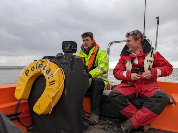
Investigator (MCA Category 3) and Polecat II (MCA Category 6) are both piloted by our in-house commercial skipper and certified RYA trainer; ensuring an uncompromised level of operational safety.
Our survey teams all undertake rigorous marine safety training in a challenging coastal environment. All surveyors are certified to RYA Powerboat Level 2 and qualified as ‘STCW Proficiency Personal Survival Techniques’ as a minimum.