About Us
About Us
Established in 2004, LandScope Engineering has become one of the leading survey companies in the UK specialising in integrated survey solutions above ground, below ground, and underwater. Our expert team includes members of the Chartered Institution of Civil Engineering Surveyors (MCInstCES) and Royal Institution of Chartered Surveyors (MRICS). With over 18 years’ experience, we have built a strong reputation as a reliable, efficient, and quality-driven survey company with customers across all sectors.
A strong core geospatial competency allows us to leverage maximum value from the latest application technologies, including mobile solutions from airborne, vehicle-based, and survey vessel platforms.
We aim to simplify the process of acquiring and managing critical data throughout the life-cycle of our customers’ projects. The rigorous planning, management, and delivery of thousands of projects has served to reinforce that quality and technical certainty is inextricably linked to measures taken to safeguard the integrity of and maximise the value of data.

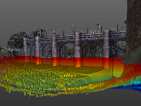
Above Water
We offer either terrestrial-based laser scanning and photographic systems or a mobile mapping-based solution. In each case, the Lidar and photographic data sets are accurately georeferenced to ensure maximum value is derived by end-users.
Underwater
We utilise the latest 3D multibeam sonar systems for underwater inspections, allowing us to acquire high-resolution point cloud data beneath the waterline. The resultant level of detail and accuracy of the data, even in turbid, fast-flowing water, provides for greatly increased detail either as a complementary or replacement service to the traditional diver-based inspection of underwater surveys.