MOBILE
SURVEY SOLUTIONS
LandScope are industry leaders in the investment and adoption of mobile survey solutions for integrated above ground, below ground and underwater survey. Mobile survey solutions offer time and cost savings to our clients, reducing the need for traffic management and overall time on site, as well as offering significant health and safety benefits by removing survey personnel from at-risk environments. We operate the latest mobile mapping and mobile GPR systems from industry leaders Leica and Kontur (formerly 3D-Radar), and our experienced team are on hand to advise on the best survey methodology for your project.
HIGH RESOLUTION ABOVE GROUND SURVEY
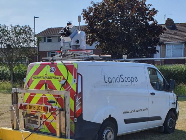
Mobile mapping has become a core service at LandScope, changing the way in which we measure, map, visualise, and analyse environments. We operate a Leica Pegasus II Ultimate mobile mapping system enabling a rapid, safe, and cost-effective survey solution whether on the road, rail, or water.
Mounted on our bespoke Chapter 8 compliant Highways Survey Vehicle (HSV), the mobile mapping system simultaneously captures high-resolution panoramic imagery and high-density point cloud data whilst travelling at highway speed, often removing the requirement for costly traffic management.
HIGH-RESOLUTION SUB-SURFACE MAPPING
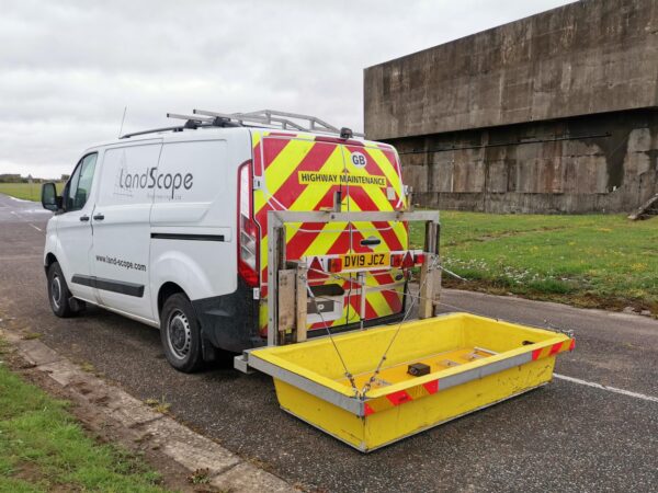
LandScope has been providing utility mapping services since 2004 and are industry leaders in the application and development of innovative technologies and workflow management. Our GNSS and IMU aided mobile GPR systems from Kontur (formerly 3D-Radar) is towed by a Chapter 8 Highways Survey Vehicle (HSV) and can capture the sub-surface environment quickly and efficiently whilst travelling at highway speed. Mobile GPR reduces project costs, traffic management requirements, time required on-site, and overall risk.
HIGH-RESOLUTION UNDERWATER SURVEY
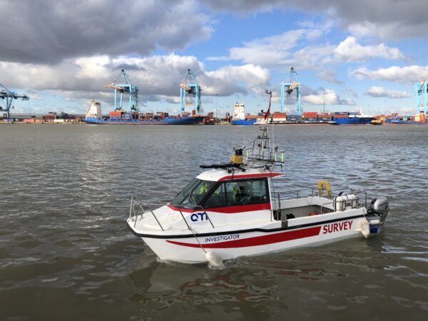
LandScope are one of the leading providers of inshore and coastal hydrographic survey services in the UK, with a proven track record in all environments from small rivers and lakes to estuaries and coastal waters.
All our survey vessels are road transportable to facilitate a quick response and rapid mobilisation. Our survey vessel Investigator is coded for 20 miles offshore and custom fitted with multiple sensors including multibeam echo sounder, high resolution scanning sonar and marine mobile mapping. Geophysical sensors can also be installed as required.
HIGH-RESOLUTION AERIAL SURVEY
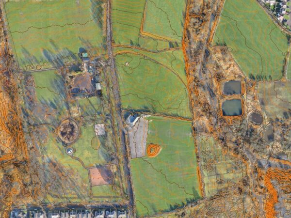
Drone surveys offer rapid data acquisition and are an efficient, cost-effective, and safe solution for inspection and survey of difficult to access areas and mapping of large sites.
Our skilled pilots are CAA approved, insured, and licensed. Our UAV fleet includes both fixed-wing and multi-rotor systems – Sensefly eBee X, Falcon8 and DJI Phantom 4 Pro.