MARINE ASSET
INSPECTION
Underwater inspections are a critical component of any marine asset maintenance or management programme. Our underwater asset inspection service has been developed to efficiently and accurately capture the above and below water environment using the latest sonar, visual, and NDT technologies. We capture high resolution, georeferenced data sets, both above and below the waterline, to ensure the highest quality 3D modelling and input to our customers’ asset management systems.
Our versatility in deployment techniques and platforms allows us to acquire the highest resolution underwater data in even the most constrained and challenging environments.


THE SURVEY TECHNIQUES
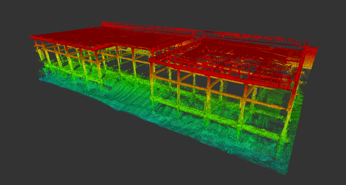
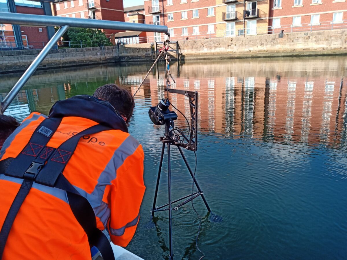
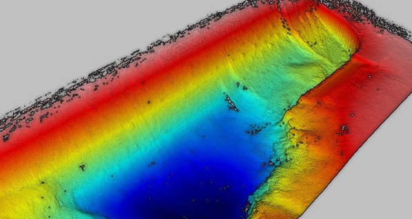
The use of integrated methods for acquiring survey data allows for complete coverage and visualisation of both the topside of structures and the underwater survey elements. LandScope deploys the latest technologies including vessel mounted mobile mapping systems, multibeam echo sounders and scanning sonars. Additionally, we can acquire underwater georeferenced photography, photogrammetry and video data through ROV surveys or diver deployed system.
We have developed techniques to bring all acquired geospatial data sets into one 3D inspection model that can feed directly into our clients’ asset management information systems. Our survey approach provides a cost-effective, data-driven asset inspection and management solution. The survey and inspection outputs can be delivered in any customer-defined format or alternatively served via the cloud.
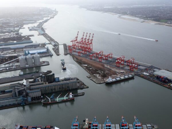
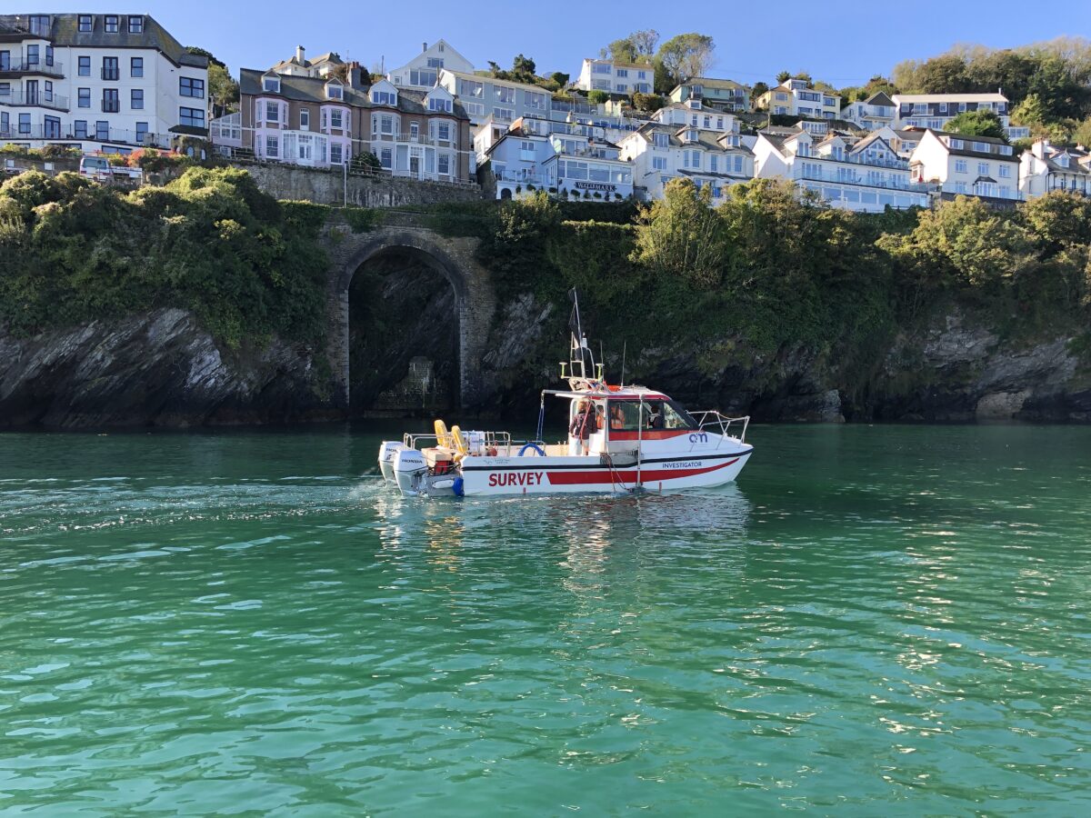
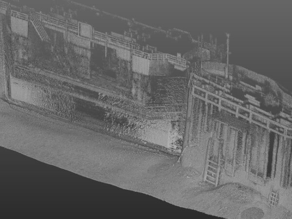
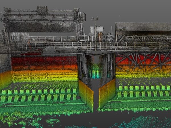
PORTS AND HARBOURS
Despite the challenging nature of working within port and harbours, LandScope are able to provide our survey and inspection service either independently or as a combined end to end asset infrastructure management project. Jetty and terminal inspection are often complex with access restrictions and the need to work around live operations. Each survey campaign benefits from bespoke design to ensure maximum data recovery and minimal disruption to commercial operations.
The skills and experience of our marine survey team, and deployment of the latest technologies, enables us to efficiently map, measure, model and visualise marine assets and their condition.
COASTAL AND FLOOD PROTECTION
The dynamics and forces at our shorelines are natural and often unstoppable. With the predicted rise in global sea levels, the accurate and detailed mapping and modelling of our tidal river and sea defences are of paramount importance in the protection of our onshore built infrastructure.
Scheme design – whether new, upgraded or maintenance based – requires accurate survey information to arrive at a sustainable and balanced design.
LandScope specialises in this coastal and inter-tidal environment with the deployment of air, land, and marine-based survey platforms to derive the complete picture.
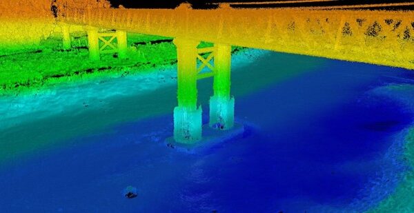
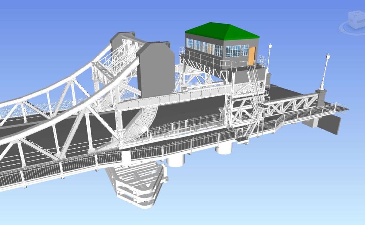
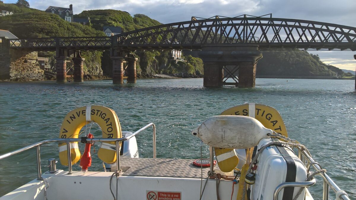
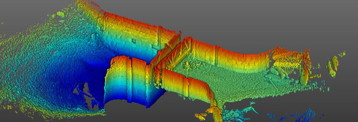
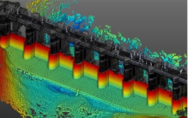
BRIDGES AND STRUCTURES
Often involving survey in higher flow and turbidity conditions the deployment of high resolution sonar survey techniques provides an asset inspection solution which would be most challenging and potentially dangerous to traditional diver approach. Our advanced positioning systems allow for the accurate geo-referencing of underwater datasets even when GNSS/GPS visibility is challenged under the bridge structure.
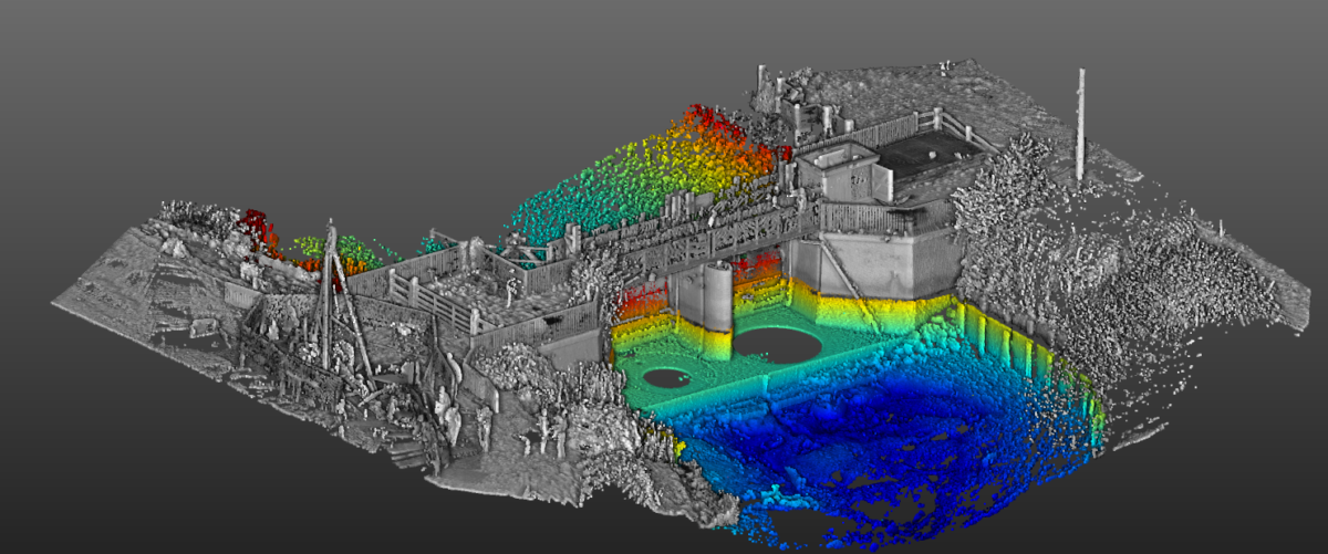
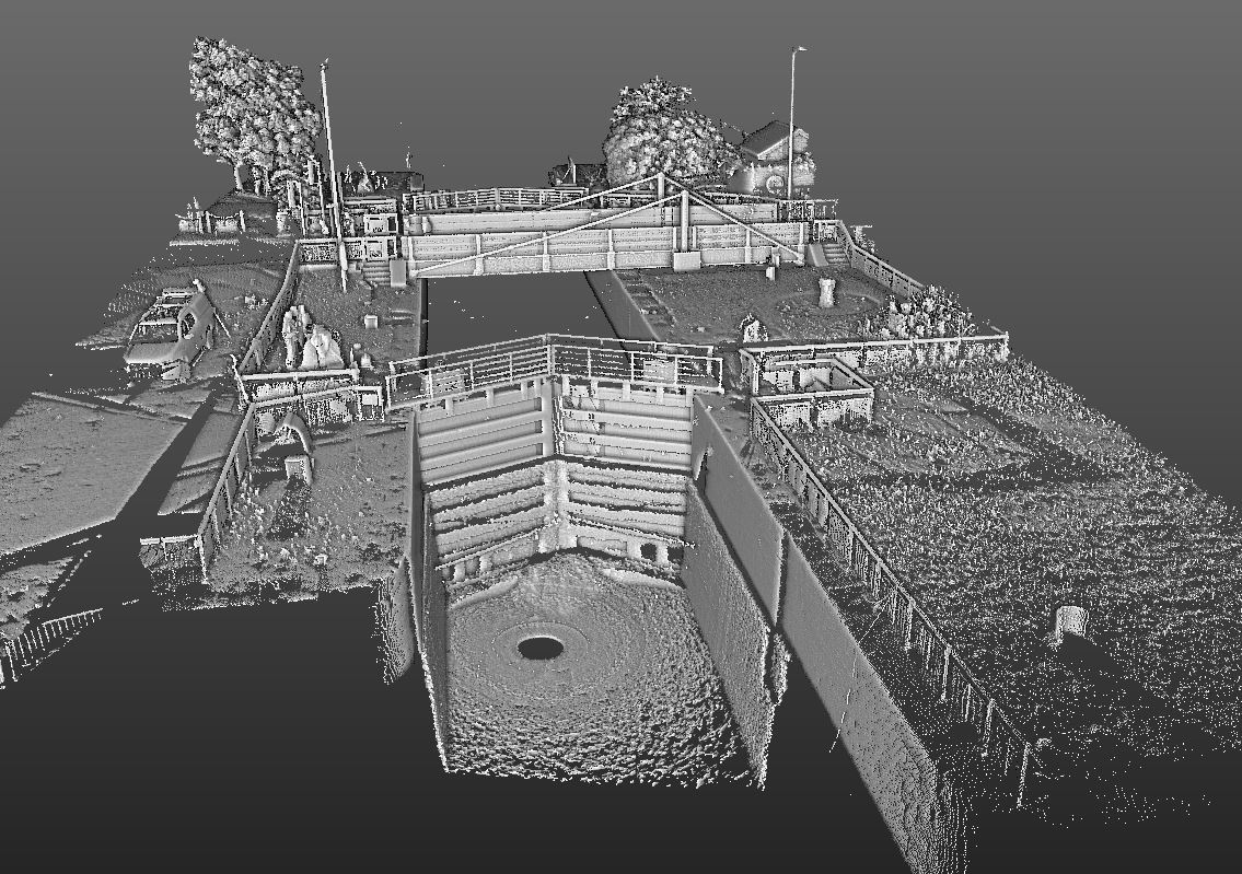
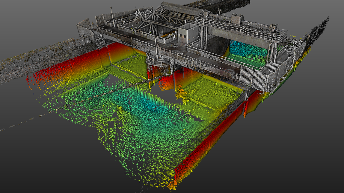
INLAND WATERWAYS
Canals and rivers form a large part of LandScope’s marine asset modelling and asset inspection diet. Projects include the survey of critical infrastructure on navigable waterways, the modelling of water intake systems, the condition monitoring of river defence walls and the routine visual inspection of sluices and flood defences. Often integrated with terrestrial and aerial acquisition systems the advanced underwater modelling techniques are now critical to these great assets.
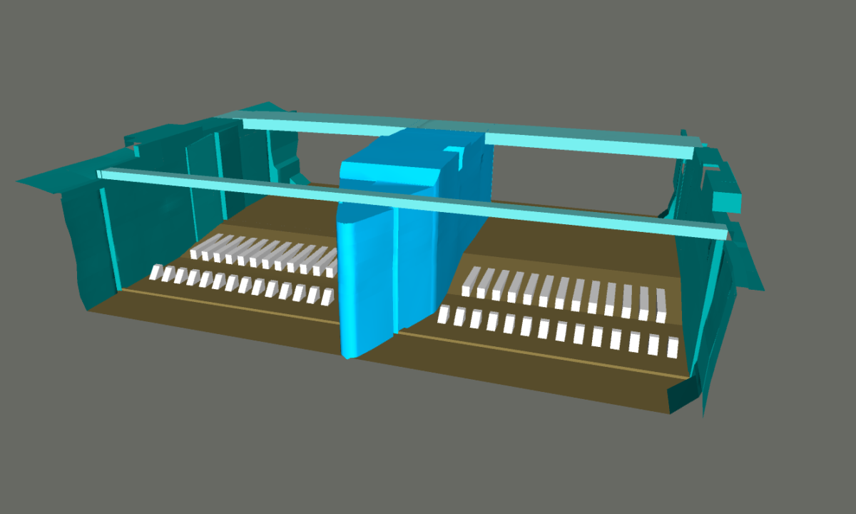
DAM AND RESERVOIR SURVEYS
Reservoir and dam structures bring their own unique set of challenges for underwater asset modelling and inspection, including water depths, flow control and access. Our reservoir survey design is unique to each structure and will usually combine a palette of survey technologies including high resolution multibeam sonar, USVs, and ROVs.
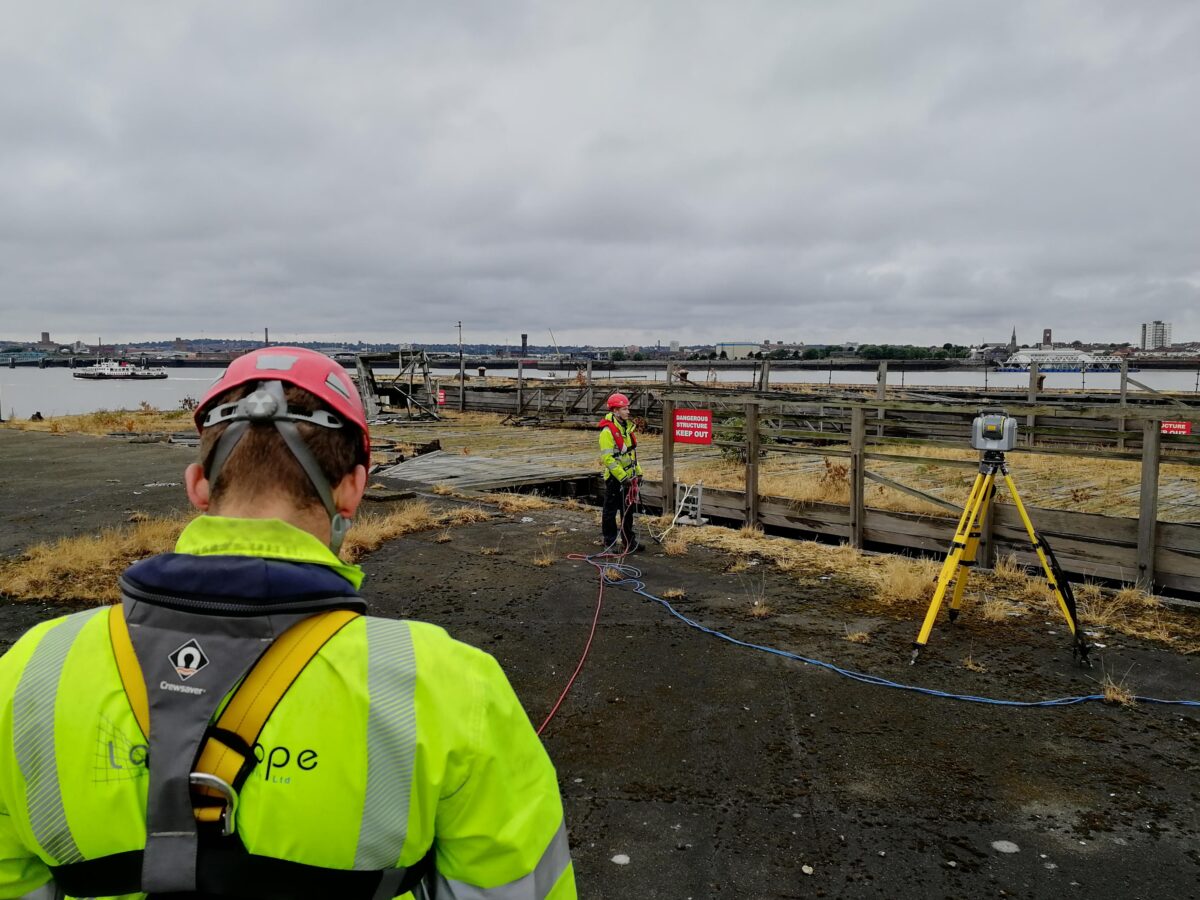
MARINE HEALTH AND SAFETY
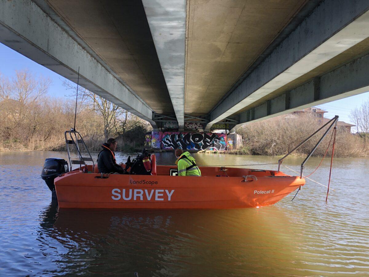
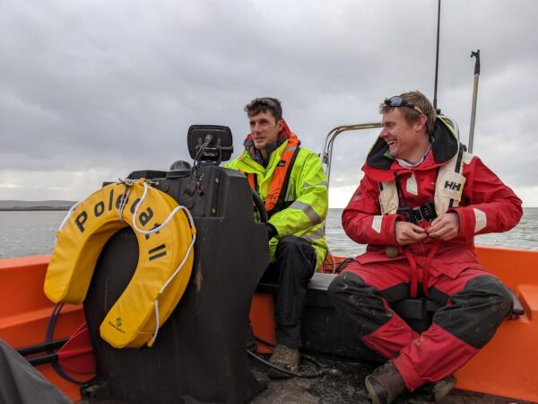
Investigator and Polecat II are MCA coded and piloted by our in-house commercial skipper and certified RYA trainer, ensuring an uncompromised level of operational safety.
Our survey teams all undertake rigorous marine safety training in a challenging coastal environment. All surveyors are certified to RYA Powerboat Level 2 and qualified as ‘STCW Proficiency Personal Survival Techniques’ as a minimum.