MARINE
GEOPHYSICAL SURVEY
We offer professional marine geophysical surveys to enhance our hydrographic services. Using the latest technologies and techniques, we design effective and reliable surveys to support marine engineering and environmental projects. Accurate underwater positioning – using IMU, USBL acoustic, and altimetry sensors – is crucial for detecting features or changes in the seabed’s material composition. We tailor our geophysical and positioning systems to meet each project’s needs, and they can be easily installed on our dedicated survey vessels.
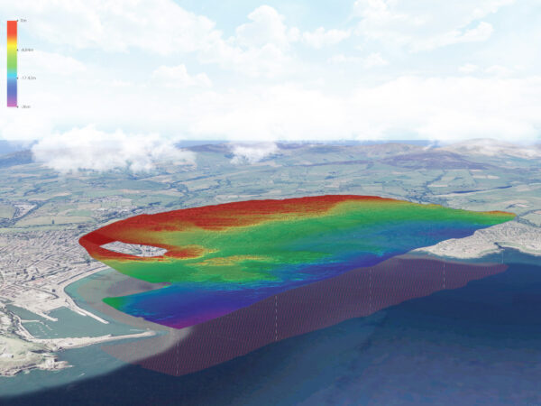
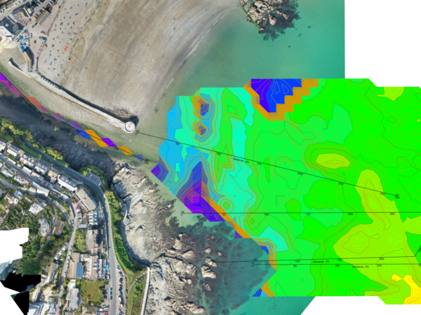
BACK SCATTER MULTIBEAM
Combining multibeam bathymetry with backscatter (reflectivity) data provides a powerful tool for understanding the nature of the seabed. These datasets reveal valuable details about the bed’s composition and character, including material types and habitats, supporting both engineering and conservation efforts. Our Norbit multibeam systems deliver top-quality backscatter data, routinely collected during all multibeam surveys.
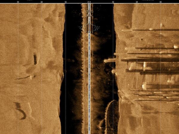
SUB-BOTTOM PROFILING
Sub-bottom profilers detect and measure sediment layers beneath the seabed. These acoustic systems use lower frequencies than standard bathymetry, allowing them to penetrate sand, silt, and rock to visualise sediment layers. This helps create a comprehensive picture during marine and river surveys. LandScope deploys various sub-bottom mapping systems, including Ground Penetrating Radar (GPR for freshwater), acoustic sub-bottom profilers, and high-resolution multi-channel seismic systems, tailored to the environment.
MARINE MAGNETOMETRY
Marine magnetometry measures variations in the magnetic field of the seabed and underlying seafloor. Systems are towed at low altitudes behind the vessel to ensure high signal quality. Magnetometry is commonly used for locating submerged or buried magnetic anomalies, such as unexploded ordnance (UXO), archaeological artifacts, sunken vessels, structures, and shallow geological features.
SIDE-SCAN SONAR
Side-scan sonar systems are chosen based on water depth, target size, resolution, and coverage needs. These systems create high-resolution, georeferenced mosaics, allowing clear identification of seabed features. Side-scan data often complements multibeam bathymetry and backscatter datasets. With wide swath coverage and precise USBL positioning, surveys are both efficient and accurate.
IN-HOUSE GEOPHYSICISTS
Our experienced in-house geophysicists bring national and international expertise in land and marine geophysics. They provide tailored advice on survey design, acquisition strategy, data quality control, processing, and deliverables to ensure the best solutions for your project. Get in touch with our friendly team below to enquire about our marine geophysical surveys.