Surveying 8km of Live A-Road Without Traffic Management
LandScope was commissioned by a local authority to survey several A-roads. The data was required urgently to support a resurfacing programme.
The scope focused on capturing accurate kerb-to-kerb highway data across an 8km corridor.
The Challenge
Surveying live A-roads presents several challenges.
Firstly, the roads were busy and required minimal disruption.
Secondly, parts of the route were needed immediately, while others were planned for later phases.
Finally, traditional survey methods would have required traffic management, extended site time and increased cost.
As a result, a faster and safer approach was required.
The Solution
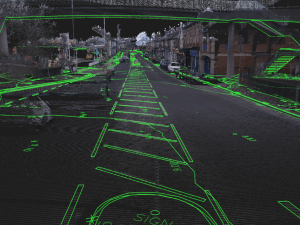
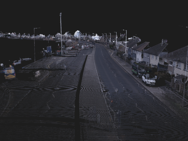
To meet both programme and accuracy requirements, LandScope deployed mobile mapping using the Leica Pegasus Two Ultimate system.
Data was captured rapidly across the corridor, with a focus on maintaining consistency and quality throughout.
To validate the dataset, strategically placed independent check points were taken along the route. These were used to verify positional accuracy and ensure the data met the requirements for its use.
The system was calibrated prior to survey, and data was captured under controlled conditions to minimise drift and maintain reliability across the full extent.
Processing followed a structured workflow, including alignment, verification against ground control and QA checks. This ensured the final dataset was accurately referenced, consistent and suitable for assessment.
This approach enabled high-speed data capture while still applying the core principles of geospatial surveying, delivering a dataset that can be used with confidence.
Key Benefits
The use of mobile mapping delivered clear advantages.
- Faster mobilisation and data capture
- Programme reduced by more than a factor of 10
- No traffic management required
- Minimal disruption to road users
- Improved safety with reduced time on live carriageways
Furthermore, priority sections were processed and delivered first. This supported immediate design requirements without delay.
Deliverables
The project delivered a complete and structured dataset.
- High-density, georeferenced point cloud
- 3D CAD drawings
The Outcome
The entire 8km corridor was captured in a single visit.
As a result, the client received both urgent data and a full dataset for future use. This removed the need for additional site visits later in the programme.
In addition, the survey was completed using an electric vehicle. This reduced the environmental impact and supported a more sustainable approach.
Conclusion
Mobile mapping provided a fast, safe and efficient solution for highway surveying.
Most importantly, the value is not just in the drawings. The real benefit is the high-quality data captured once and used many times.