UAV LiDAR Flood Defence Survey London – Southwark Riverside
9km UAV LiDAR Survey Delivering Flood Defence Data in Central London
Overview
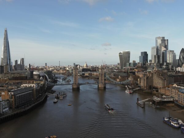
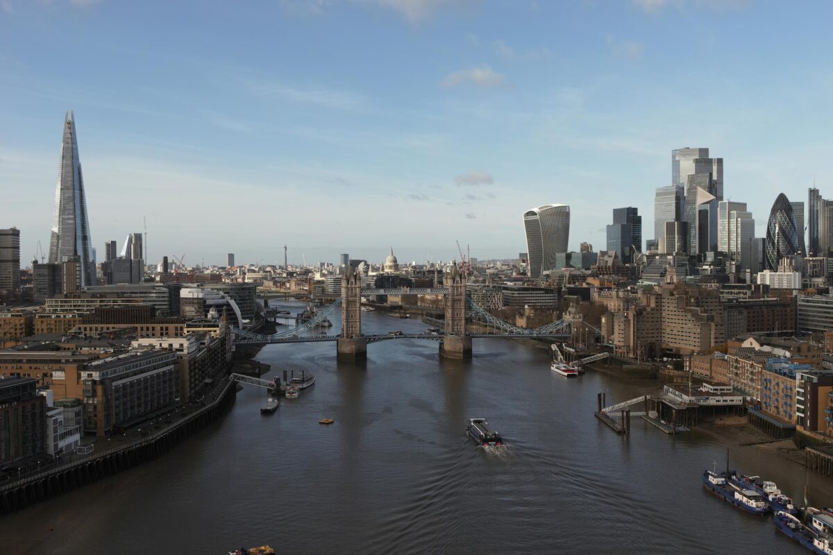
LandScope Engineering delivered a UAV LiDAR survey in London across more than 9km of the Southwark riverside corridor.
Specifically, the project supported flood defence assessment, environmental analysis, and stakeholder engagement.
The primary objective was clear. We needed to capture accurate crest height data of river walls. In addition, the survey had to provide insight into ecological, cultural, and infrastructure constraints.
Scope of Works
The project included:
-
- UAV LiDAR survey of a 9km riverside corridor in central London
- Capture of flood defence crest height data
The Challenge
Delivering ‘Survey Grade’ flood defence survey in central London created several challenges.
- The site was a dense urban environment.
- The corridor extended over 9km.
- More than 20% of the area was inaccessible by foot.
Furthermore, multiple landowners restricted access. At the same time, several locations were highly sensitive, including:
- Heritage sites
- Public spaces
- Active infrastructure
As a result, traditional survey methods would have taken several weeks. Consequently, this would increase cost, disruption, and risk.
Our Approach – UAV LiDAR Survey Solution
To overcome these challenges, LandScope deployed a UAV LiDAR survey combined with aerial imagery.
As a result, we captured accurate data quickly and safely.
Advanced Data Capture
- UAV-based LiDAR scanning for precise elevation data
- Creation of digital terrain models (DTM)
- High-resolution imagery for asset identification
- Rapid data capture across inaccessible areas
Stakeholder & Airspace Management
Given the complexity of central London airspace, detailed planning was essential.
Therefore, we coordinated with key stakeholders, including:
- Heritage and protected sites
- Hospitals and public infrastructure
- Commercial and public spaces
- Construction teams operating cranes
- River authorities and enforcement teams
As a result, all operations remained fully compliant with UK aviation and safety regulations.
Overcoming the Challenges
Through this approach, LandScope achieved the following:
- Safe operations in high-footfall areas
- Access to previously unreachable sections
- Efficient coordination across stakeholders
- Fully compliant UAV operations
Deliverables
- High-accuracy 3D CAD drawings
- Dense LiDAR point cloud datasets
- Processed elevation models
- Flood defence crest level data
- Drainage and asset mapping information
- Data ready for integration into client systems
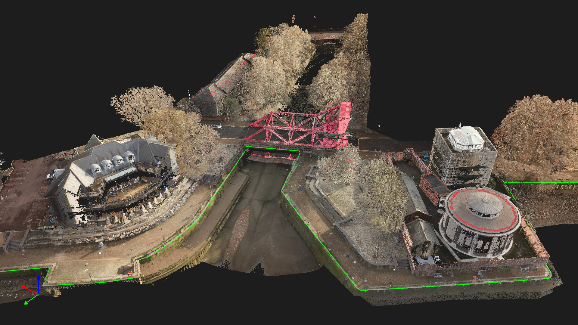
Point Cloud data highlighting crest level through a lock
The Outcome
- Ultimately, the UAV LiDAR survey delivered measurable benefits.
- Programme Efficiency – Survey time reduced by over 90%
- Cost Savings – Reduced site time lowered overall project costs
- Improved Safety – Fewer personnel required in high-risk areas
- Enhanced Data Quality – High-density datasets improved decision-making
- Reduced Disruption – Low-impact survey within a busy urban environment
Project Value
As a result, the data enabled the client to:
- Identify flood defence levels and risk areas
- Highlight heritage and cultural constraints
- Map ecologically sensitive zones
- Support stakeholder engagement strategies
- Deliver high-resolution geospatial data for design
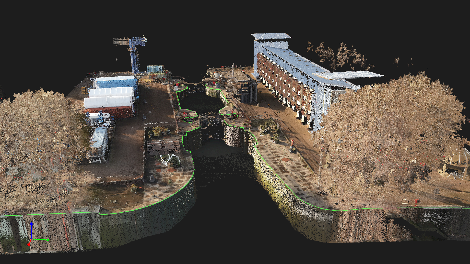
Pointcloud data through a complex lock
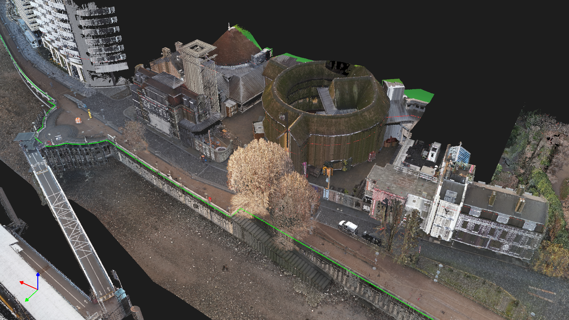
Shakespear Globe
Click here to see the video of the Pointlcoud data: Pointcloud Animation
If you are planning a similar project, LandScope delivers UAV LiDAR surveys in London and across the UK.
Therefore, if you need fast, accurate, and cost-effective survey data, we can help.