FLEXIBLE DELIVERY
ABOVE GROUND^1000 BELOW GROUND^1000 UNDERWATER^1000
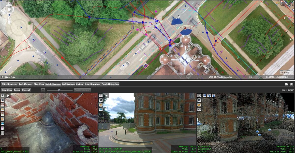
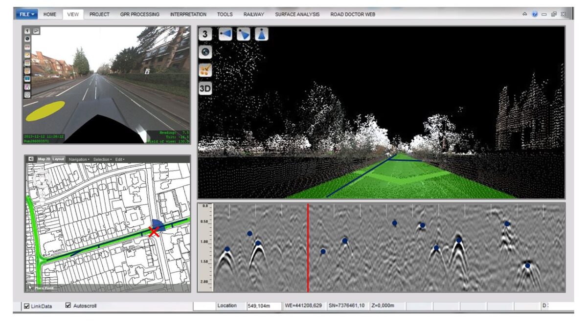
As survey systems evolve and become increasingly sophisticated, there is an emergence of new formats and greater volumes of data. Our clients retain a strong reliance on traditional CAD models – albeit now usually in 3D – however, there is a growing appreciation of how these new larger and richer survey datasets can add significant value to their projects.
The resolution of survey data is now at a level whereby it is often used for the creation of virtual models of our natural and built environment. The rapid adoption of these digital twins into the AEC industry has developed a greater reliance on the survey practitioner.
At LandScope we appreciate fully the value of survey datasets and will always endeavour to best advise our clients on how best to manage this value. Whilst we have our preferred workflows and software solutions, we remain agnostic and cognisant of our clients’ specific systems. We always undertake to deliver survey data to our client’s specifications and desired formats.
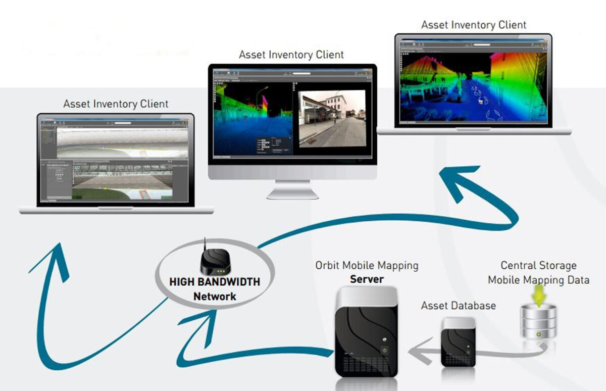
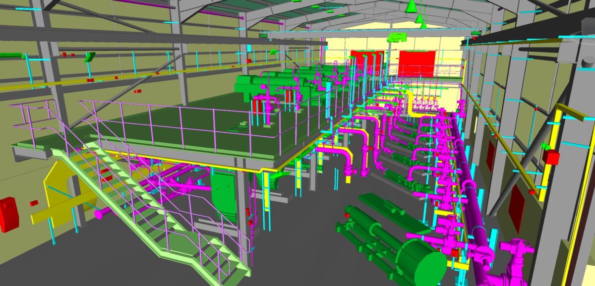
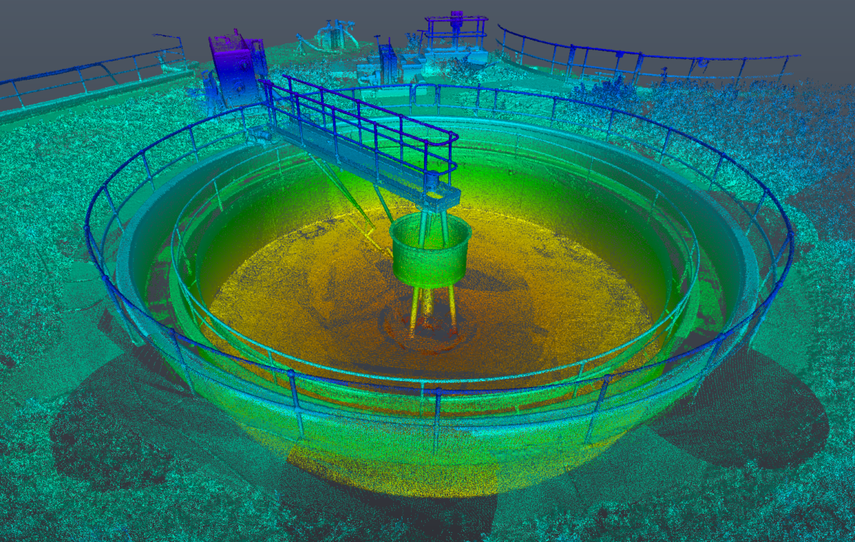
Our mobile mapping solutions – above ground, below ground and underwater – acquire the highest resolution LiDAR, photogrammetric, geophysical and sonar datasets. These data sets are used to satisfy specified survey deliverable outputs; however, they can provide much more. For example, a mobile mapping dataset, used primarily for topographical model production, may also inform on asset management, condition assessment and digital twin development. We work with our clients to unlock this greater potential.
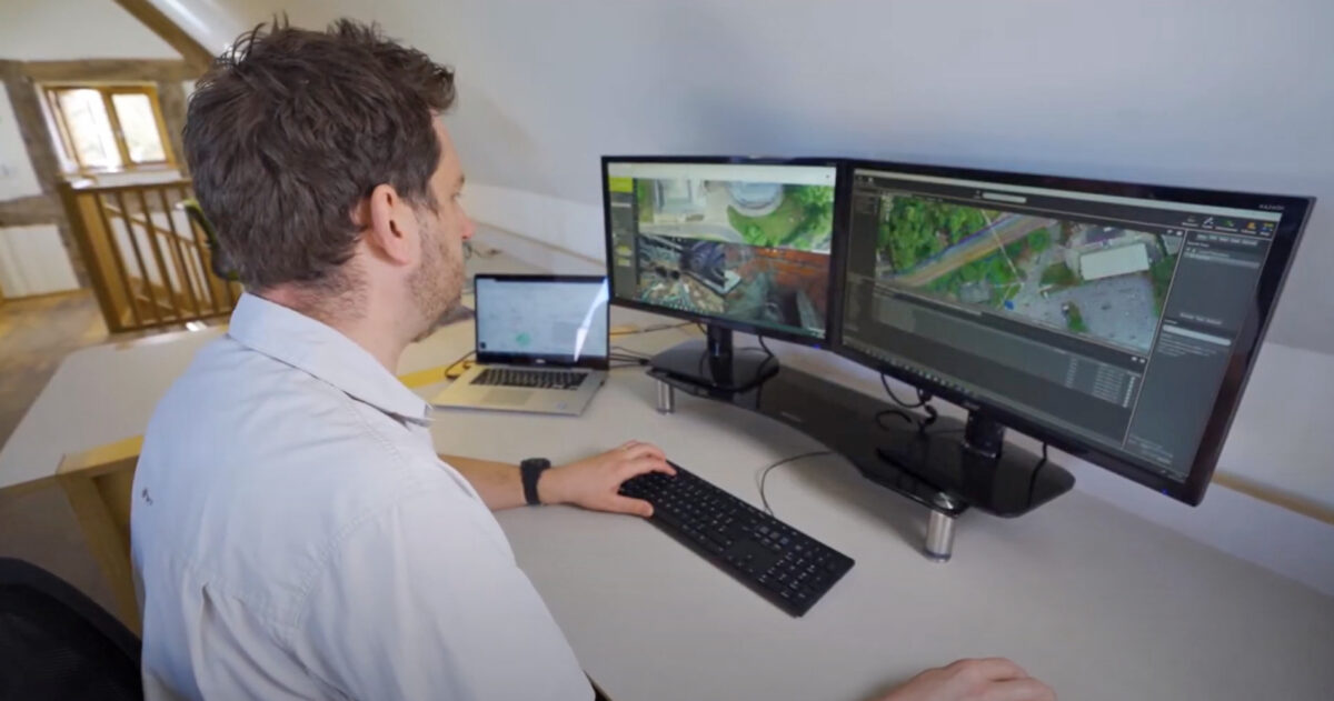
LandScope are continually developing end-user experiences, providing accessible visualisation of 3D data to all our clients, enabling users to obtain the increasingly beneficial results, and added value, which our modern sensors and workflows have to offer.


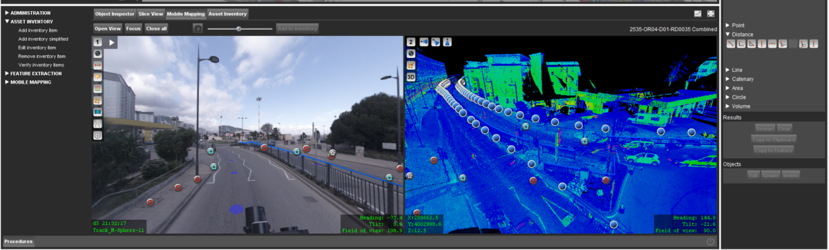
Data Modelling & Sharing
The volumes and complexities of survey data appear to be on an ever-increasing scale. The challenge of managing these datasets requires appropriate IT infrastructure and software, with an increased appreciation of data quality. Whilst the options for software solutions are plentiful, the reliance on the surveyor’s appreciation for data quality, accuracy, and reliability/technical certainty, is now greater than ever.
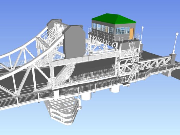
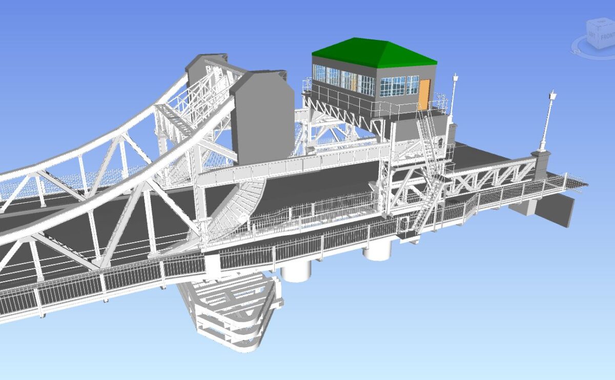
Digital Twins
A digital twin is a virtual (or digital) model of a real-world physical object. An accurate and high-resolution digital counterpart may be used in future design and integration, in addition to life-cycle asset management. The value-based use of the digital twin will govern the type, accuracy, and resolution of survey data required – and the surveyor must be well prepared o understand this concept.