Increasing Efficiency on Site: Bespoke App for Recording Underground Data
In our drive to go paperless, LandScope have developed a bespoke app to record manhole and inspection chamber information whilst on site.
This app based solution for recording data offers many benefits both in-house and to our clients.
Data is entered into the app, or Electronic Underground Feature Record (EUFR), and uploaded real-time to the central GIS database with its georeferenced location recorded. Legacy data can be easily revisited when future works are planned and with both standard and 360-degree images stored within the EUFR, the need to re-lift or re-survey manholes in the future is significantly reduced.
Real-time access enables the field teams to review data from adjacent areas, complete a gap analysis and plan outstanding work in advance. Auto reporting and GIS exports also mitigates much of the costly office-based processing tasks.
The Electronic Underground Feature Record captures a wealth of information including service type, pipe depth, size and material as well as connectivity information, helping to establish underground networks. This data can be delivered to our client as a PDF or digital form.
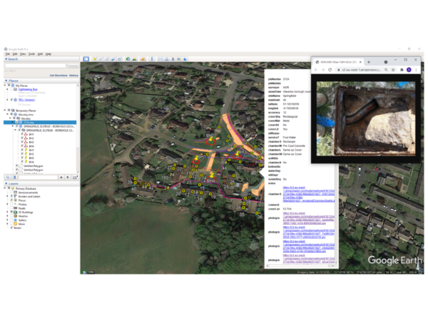
The image below shows a sample data set delivered within Google Earth; clicking on the asset reveals the data associated with the manhole or inspection chamber and from here you can access any associated imagery.
If you would like more information on any of our utility mapping survey solutions please contact our commercial team on 01694 731930 or enquiries@land-scope.com.