BRIDGES &
STRUCTURES
ABOVE THE WATERLINE BELOW THE WATERLINE
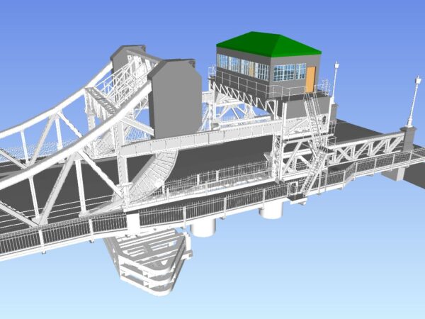
LandScope has developed versatile solutions that address the numerous challenges of bridge survey and inspection. This includes the integration of the latest sonar technologies, our mobile mapping system, terrestrial laser scanning and photogrammetric imaging.
ABOVE WATER
We offer either terrestrial-based laser scanning and photographic systems or a mobile mapping-based solution. In each case, the Lidar and photographic data sets are accurately georeferenced to ensure maximum value is derived by end-users.
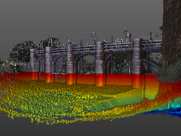
UNDERWATER
We utilise the latest 3D multibeam sonar systems for underwater inspections, allowing us to acquire high-resolution point cloud data beneath the waterline. The resultant level of detail and accuracy of the data, even in turbid, fast-flowing water, provides for greatly increased detail either as a complementary or replacement service to the traditional diver-based inspection of underwater surveys.