MARINE OPERATIONS
LandScope Engineering is a leading provider of inshore and coastal hydrographic survey services in the UK, with a proven track record in all environments from small rivers and lakes to estuarine and coastal waters. Mobile mapping provides an extension to our marine survey capability.
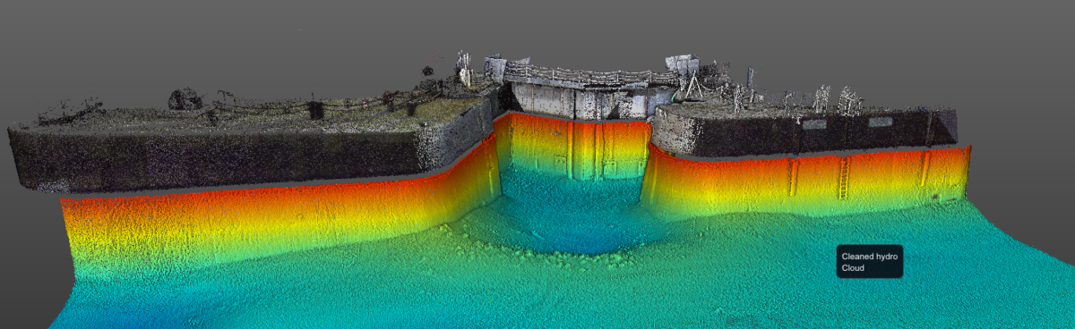
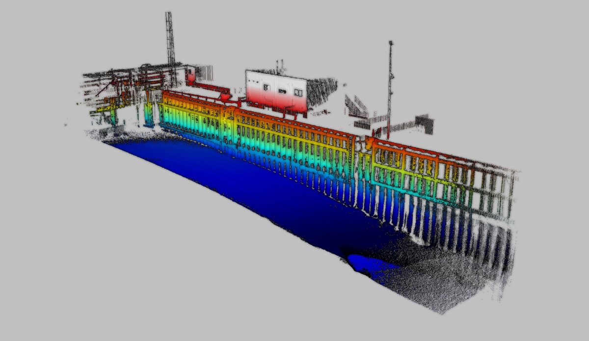
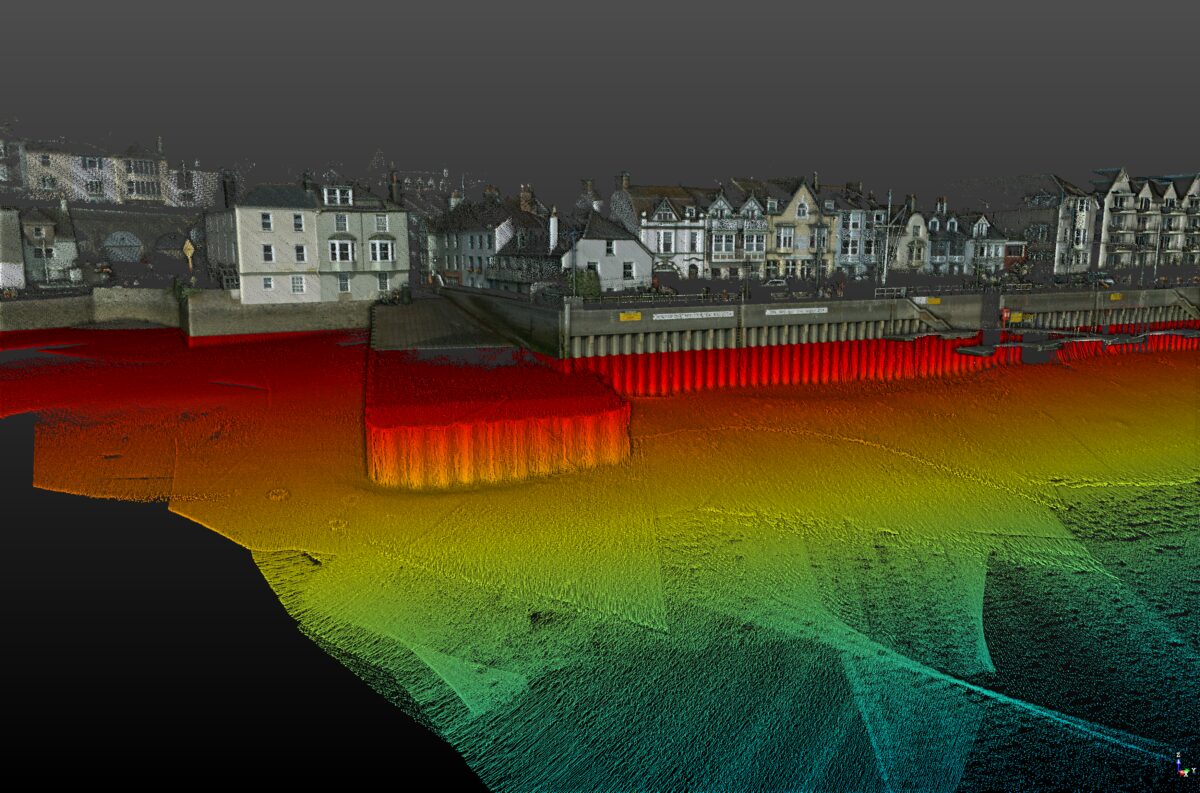
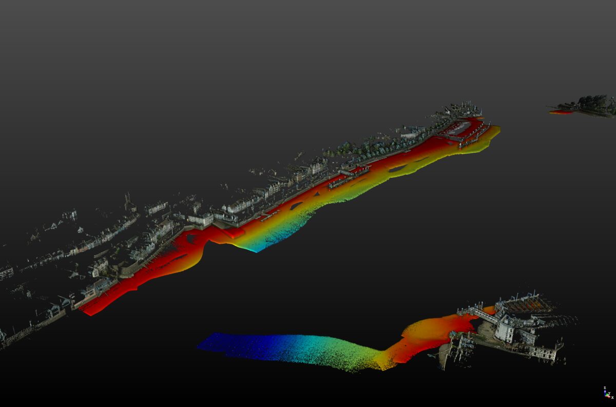
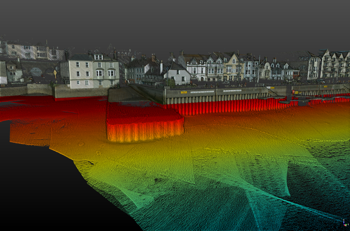
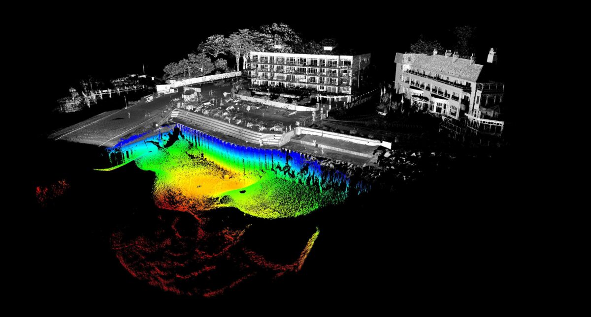
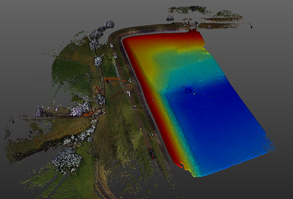
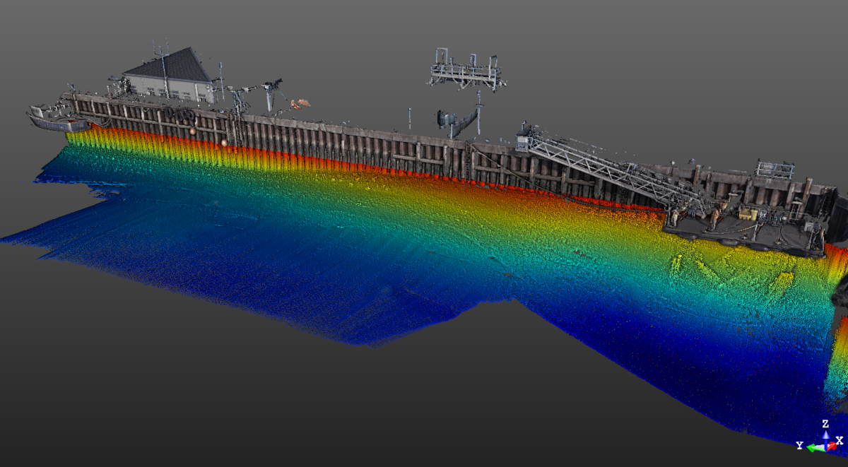
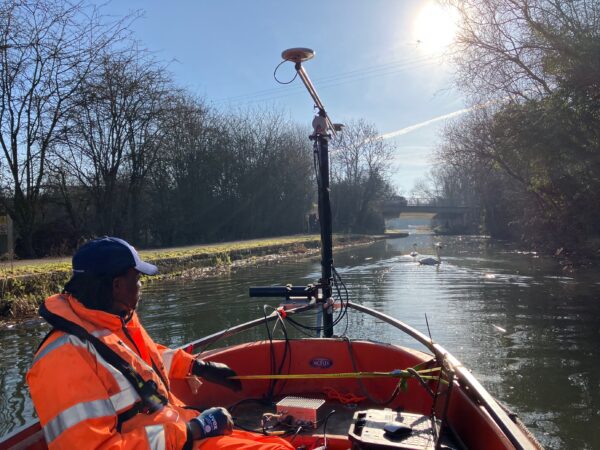
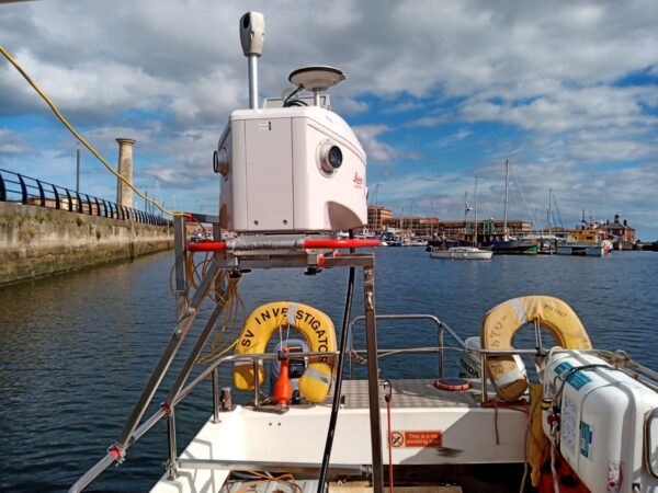
Our dedicated survey vessels may be fitted with mobile mapping systems to enable rapid and efficient capture of above water data. LandScope operate Leica Pegasus:Two Ultimate and Norbit iLiDAR mobile mapping systems which capture accurately geo-referenced point cloud data and photography of infrastructure within the marine environment. The resultant output, especially when combined with the underwater survey element, provides an unprecedented level of survey resolution both above and below the water-line.


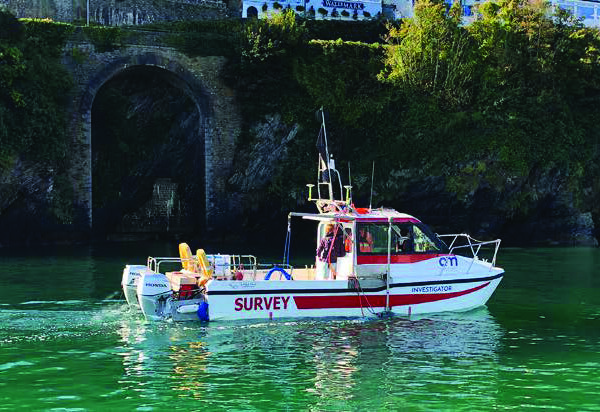
s.v.’INVESTIGATOR’
Our dedicated survey workboat s.v.’Investigator’, a Cheetah Marine Catamaran, is road transportable to facilitate a quick response and rapid mobilisation. Investigator is coded for 20 miles offshore and our experienced team include a commercial skipper and RYA accredited marine safety trainer.
s.v.’Investigator’ is custom fitted with multiple sensors including, specifically for mobile solutions:
- Leica Pegasus:Two Ultimate
- Norbit iLiDAR
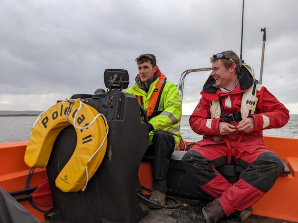
s.v.’POLECAT II’
Our nimble survey workboat, s.v.’Polecat II’, a Pioner Multi III, is road transportable, facilitating a quick response and rapid mobilisation. The vessel is highly versatile and manoeuvrable on the water owing to its lightweight but tough GPR hull design and generous load capacity. Its large open deck, drop-bow system, and bow A-frame make for easy deployment of many types of hydrographic equipment. It is superbly suited to inshore work, but also coded for up to 3 miles offshore.
s.v.’Polecat II’ is custom-fitted with deck mounting for a Mosaic 51 high-resolution panoramic inspection camera.
APPLICATIONS
- Asset Inspection – through high-resolution 360-degree imagery
- Asset Visualisation
- Asset Management
- Topographical Survey – foreshore and structures
- Coastal Management
- 3D Modelling
MARINE HEALTH AND SAFETY
Investigator and Polecat II are MCA Category 3 coded and piloted by our in-house commercial skipper and certified RYA trainer; ensuring an uncompromised level of operational safety.
Our survey teams all undertake rigorous marine safety training in a challenging coastal environment. All surveyors are certified to RYA Powerboat Level 2 and qualified as ‘STCW Proficiency Personal Survival Techniques’ as a minimum.