Mobile GPR Invaluable to Flood Modelling Scheme
LandScope has enjoyed a busy summer in Ilkeston, working as part of a team of consultants on a
hydraulic modelling and flood measure programme.
An integrated survey approach has called upon many of LandScope’s capabilities, including:
• Mobile Mapping – to produce digital terrain model (DTM) and detailed topography/surface
type.
• 3D Scanning – including for building modelling
• Under Ground infrastructure (Utility) Mapping in preparation for intervention design
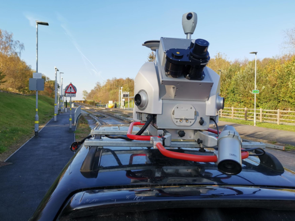
The scale of these schemes calls for mobile solutions to minimise disruption (e.g., road closures) and
meet strict deadlines. Our Kontur (formerly 3D Radar) ultra-high resolution mobile GPR system
allowed for the mapping of the entire network in two days – compared to a traditional approach
estimate of over two months.