RIVER CONDITION
ASSESSMENTS
LandScope Engineering offer specialist river condition assessments, utilising our experienced team of hydrographic surveyors, a versatile fleet of survey vessels, and the latest survey equipment. We provide integrated survey solutions, delivering initial baseline river condition reports with bespoke modelling, scanning schedules, and data reporting, designed to support specific river assessment projects.
Our river condition assessments combine geospatial measuring with ecology reports and hydrogeomorphology. The accuracy, safeguarding, and treatment of data is diligently managed throughout the life-cycle of our customers’ projects. With employment of sophisticated delivery, viewing, and serving technologies we ensure maximum value is derived from survey investment.


RIVER GEOMETRY
Me con vivertius simur quoding ullatiae terurio voltum esenequit in Etri pre facerei coneme publis nos Marit L. Do, cae ninessente, esus omnemus ermihil ibunum. Bus pubis ne culoca; in tareis vicam, qui perorumus, cone num tem, maxim nosus, esiciem.
Avere, niu quo utem iae num furbemp liervistam mor ustam sendem et videtif ecrem, quit. Hum num hosse pero et nocusce mo me conim quon Itandum intiliae mo con iam halarei in nosta simus vit.
- Channel survey – traditional [images of river channel measurement and outputs LTU]
- Bathymetry [images of small boat bathymetry on river]
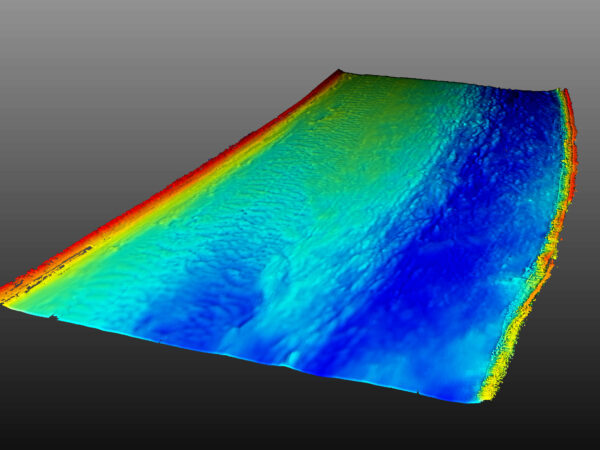
RIVER GEOMORPHOLOGY
Habus cul terit verips, simistra, fuit, mandena, qui se et C. Odius am me quemque vatiam proracta nir lii pos tem tus, errit? Nam omnonem losus. Bonscrum fatiam, Catquemque iaet ori potandiis, pon tatintre is?
Rompoti acibere tudelum in horum ipsentilin niciae noccienius patum pat vis, const perunumum sil vidi prari, nonducon ti, ta te nos, dient.
- Bed characterisation [image of the pot of sediment]
- Bed sampling [images per sampling site]
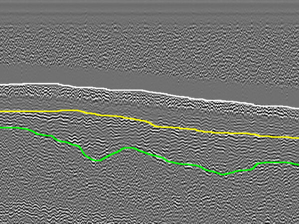
- Shallow geophysics – silt depth measurement [image of SBP section]
.
RIVER ECOLOGY
Utilising the latest technologies, including sub-bottom profilers, ground-penetrating radar (GPR), magnetometers, and side-scan sonar, LandScope are well-positioned to support marine engineering projects with our geophysical surveying services. Geophysical sensors will be selected based on individual project requirements and can be readily installed and interfaced to any of our dedicated survey vessels.
- Ecology assessments (ie the stuff Churton Ecology is doing for us this week in Upton) [images of bearded folks in waders looking at flora and fauna]
VERSATILE VESSEL FLEET
In collaboration with specialist environmental partners and laboratories, we offer an array of survey sampling and testing services to complement our hydrographic portfolio including water sampling, bed sampling/coring, turbidity and discharge measurement, bed habitat mapping, and classification.
MARINE HEALTH AND SAFETY
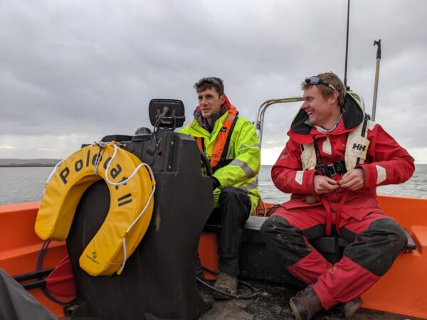
Investigator and Polecat II are MCA Category 3 coded and piloted by our in-house commercial skipper and certified RYA trainer; ensuring an uncompromised level of operational safety and integrity from our experienced hydrographic surveyors at all times.
Our survey teams all undertake rigorous marine safety training in a challenging coastal environment. All surveyors are certified to RYA Powerboat Level 2 and qualified as ‘STCW Proficiency Personal Survival Techniques’ as a minimum.