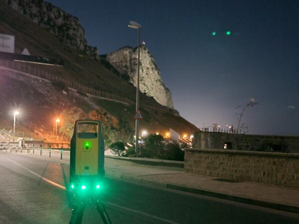
Scanning from West to East
In support of Gibraltar infrastructure upgrades LandScope have recently acquired a 1.1 Kilometre LiDAR point cloud through the East-West Admiralty Tunnel.
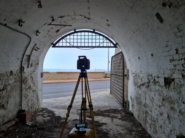
The famous tunnel, running East to West deep under the rock of the Gibraltar, became a state-of the art communication centre during World War II. It was from this fortress that the operation (nicknamed ‘Operation Torch’) to retake North Africa from the Nazis was planned and spearheaded.
Our surveyors completed a twelve leg traverse through the tunnel – with high resolution scans taken at each control station – using our Trimble SX12. Infill between stations was acquired using the self-registering Trimble X7 scanner.
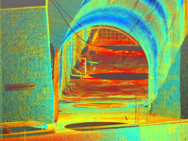
The result: the most spectacular single geo-referenced point cloud yet.