3D BIM MODELLING
SERVICES
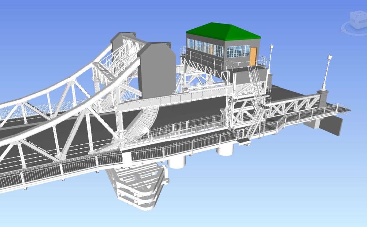
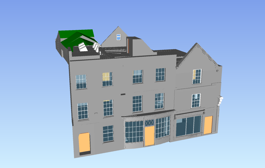
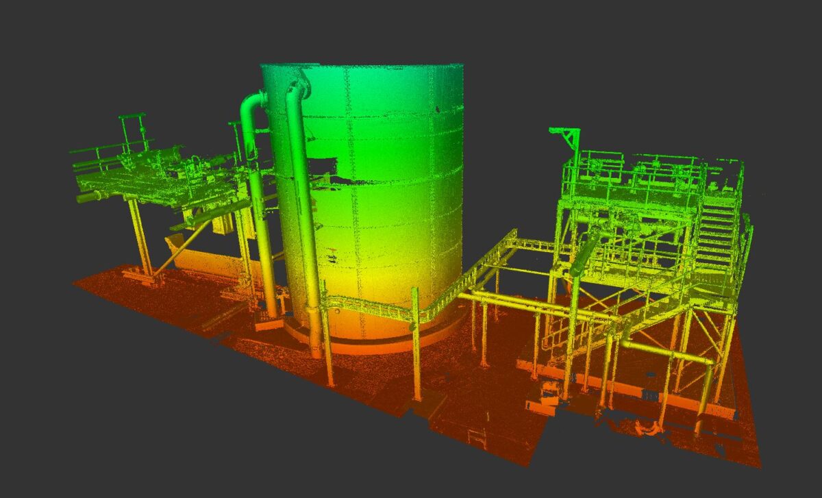
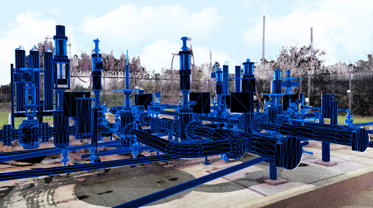
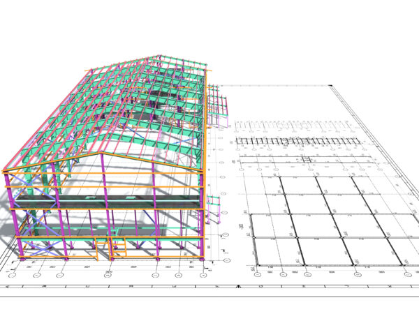
Building Information Modelling, or BIM, ensures the planning, design, and construction phases of a project are highly efficient and collaborative. LandScope utilises terrestrial laser scanning and mobile lidar to rapidly collect survey data which can then be used to create a highly accurate BIM-ready Revit model. Our in-house 3D surveying and BIM capabilities enable us to provide professional 3D laser scanning surveys to support all sectors including construction, civil engineering, plant, architecture, and structural.
Whether for building, bridge, or road network, LandScope produces accurate and reliable survey information and our team are on hand to provide guidance and recommendations on the survey methodology best suited to your project. Discover a wide range of useful information with our 3D modelling surveys and more.
WHAT IS BIM?
Building Information Modelling (BIM) is a process for generating, storing, and managing digital information for all objects and elements of a building or structure throughout its life. BIM allows multiple stakeholders to collaborate on the planning, design, and construction of infrastructure within one intelligent 3D model and can span into the operation and management of the building once construction has been completed.
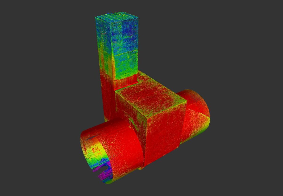
Methods such as 3D laser scanning surveys capture data and the information within a BIM model is then shared through a collaborative online space known as a Common Data Environment (CDE) and can be used throughout all stages of a building’s life from inception through to operation, renovation, and even demolition.

WHY BIM?
Our 3D modelling surveys help to:
- Mitigate risk through the provision of reliable, accurate, and highly detailed data
- Reduce cost and avoid downtime associated with construction rework or site revisits
- Encourage collaboration through a single, shared common data environment (CDE)
INTEGRATED BIM MODEL
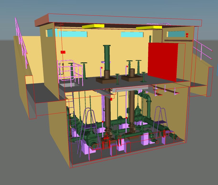
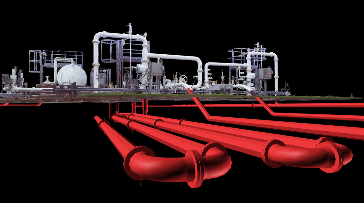
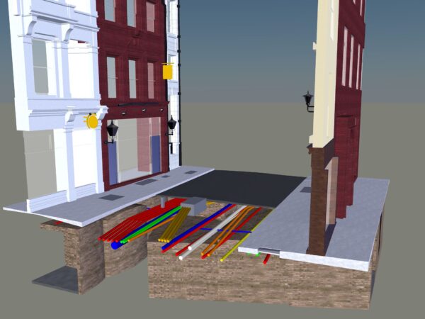
Underground and underwater data can be integrated into our BIM-ready models to create a seamless and comprehensive 3D visualisation. The inclusion of the subsurface environment offers a powerful and intuitive tool to aid with planning and risk mitigation during construction. Any potential changes within the underground environment can also be transferred into the BIM to ensure an up to date record is kept of the surface and subsurface features.