BATHYMETRIC
SURVEY
LandScope Engineering has many years of experience undertaking bathymetric surveys within all environments from small rivers and lakes to estuaries and coastal waters. Our in-house experience and expertise, and investment in the latest systems and software packages, means we can offer a comprehensive range of seabed survey services. As one of the top multibeam bathymetry survey companies, whether you need unmanned service vessels, river surveys, single and multibeam bathymetry, we can create a tailored service to meet requirements.
Having experience working in all marine environments, including river intake systems, tidal rivers and coastal waters, we are highly-confident in our ability to deploy the most appropriate vessel and survey resources for your project, which distinguishes us from other bathymetric survey companies.
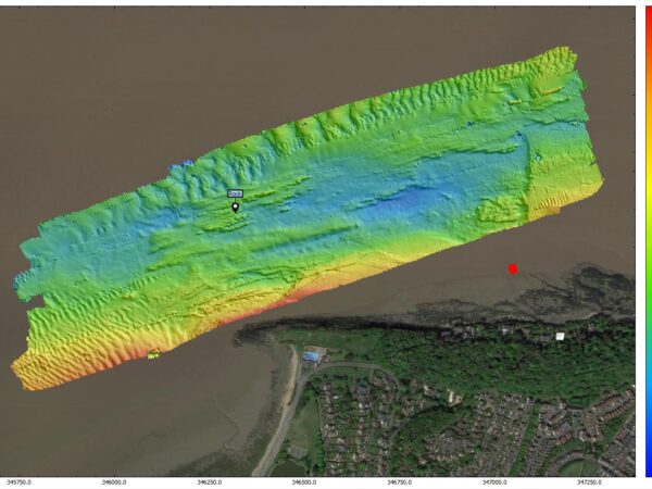
MULTIBEAM BATHYMETRY
Our survey vessels are equipped with multi-frequency swathe bathymetry for large area coverage, offering an efficient and cost-effective solution for mapping large areas in a single pass of the vessel. Multi beam bathymetry has several applications including:
- Seabed Mapping
- Geological Survey
- Dredge Support
- Underwater Visualisation
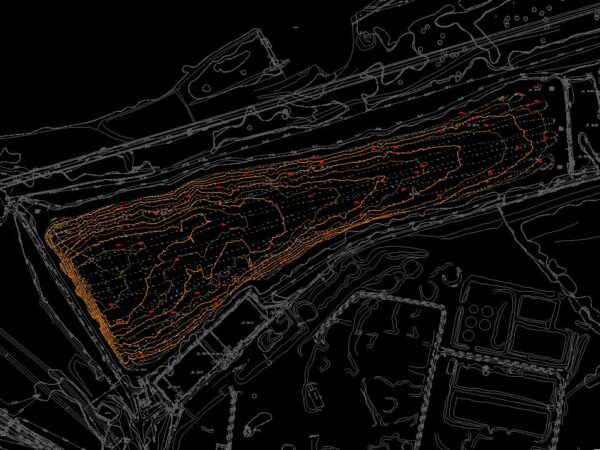
SINGLE BEAM BATHYMETRY
LandScope also operates single beam echo sounders which, although often superseded by multibeam bathymetric sonar techniques, offer value particularly in shallow water environments. Their lightweight and versatile nature means that they can be readily deployed to a variety of vessels, and, for small rivers, lakes and reservoirs, they offer a cost-effective alternative to multibeam bathymetry where a high-resolution bed coverage is not required.
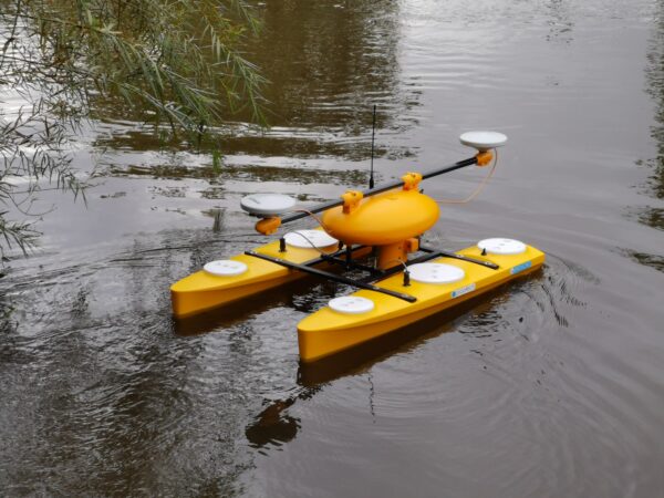
USV
In sheltered environments, such as ports, harbours, lakes and rivers, LandScope can deploy an Unmanned Survey Vessel (USV) to rapidly capture multibeam bathymetry. Based around the Picotech PicoPOD, the wide swath multibeam echo sounder makes short work of shallow water environments where it is not always possible to deploy a vessel.
With an exceptionally shallow draft and one person operation, the USV solution offers a cost effective way to capture high resolution bathymetry, often ideal for river surveys.
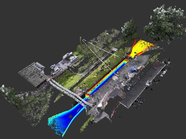
ADDING VALUE TO SURVEYS
Our bathymetric surveys can be integrated with terrestrial survey data to provide a seamless 3D model of the above and below water environment. The above water data can be acquired using UAV, traditional survey techniques or marine and land-based mobile mapping.