SPECIALIST GPR
Geophysical surveys are often required as part of the design, planning and engineering process for development projects as well as to support research and site investigations. Mobile GPR can be augmented with geophysical sensors to allow utility mapping and archaeological surveying to take place simultaneously.
We provide geophysical surveys to consultants, engineering and construction companies, archaeologists, and local councils. Our in-house team of geophysicists have diverse experience in both land and marine geophysics and are on hand to advise on the best solution for your project.

MOBILE GPR
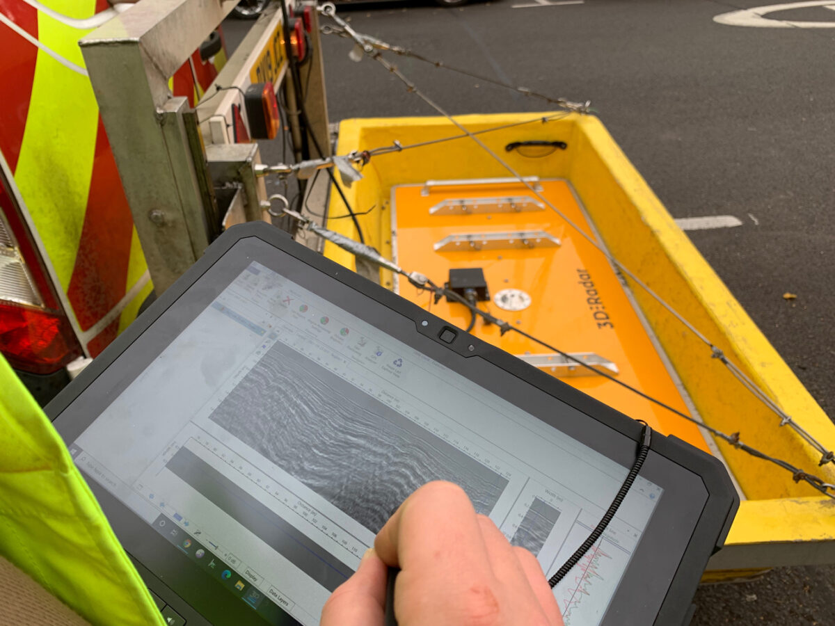
LandScope invests in the latest mobile survey solutions including a Mobile Ground Penetrating Radar system from Kontur (formerly 3D-Radar) which is capable of capturing the sub-surface environment efficiently and to the highest resolution whilst travelling at highway speed.
Not all survey environments require as fast an approach as the Mobile GPR Kontur system, and as such, LandScope have recently invested in new hand push GPR systems from Leica, including the Chaser XR and the Stream DP.
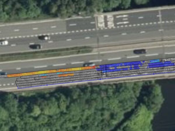
HIGHWAYS PAVEMENT SURVEY AND ANALYSIS
Geophysical surveying and other non-intrusive survey techniques can provide data to support routine monitoring of highway pavement assets in order to help with life-cycle modelling and analysis for specific pavement distress investigations. Our pavement survey service provides a cost-effective, safe, and reliable evaluation for the preservation, planning, and regeneration of roads as part of a Highways Asset Management Plan (HAMP).