That Sinking Feeling
Sink holes and dissolution features are becoming a growing concern for many areas of the UK. Geophysical investigation is a critical part of locating and mapping these features. There are many established techniques to achieve this, such as GPR, seismic, gravity, conductivity, and resistivity. The most suitable geophysical method is often selected based on environment and resolution (size) of the anticipated features.
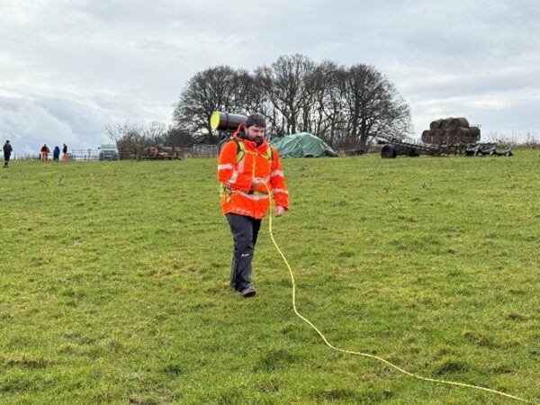
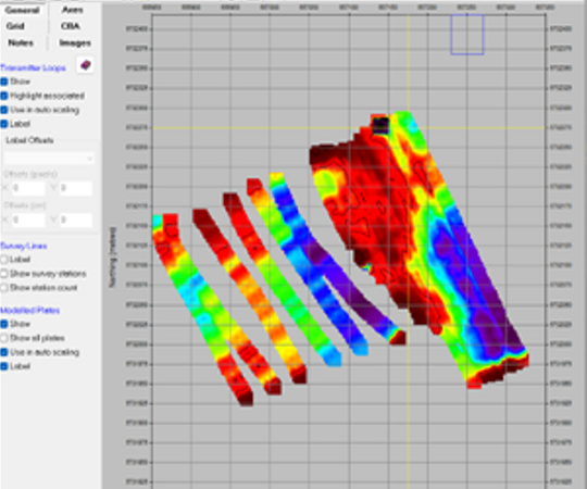
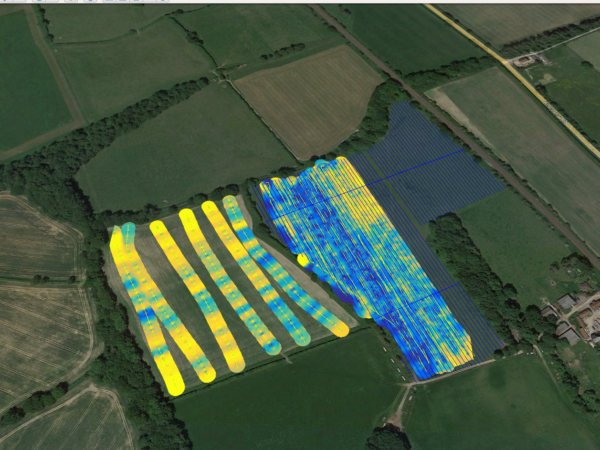
A new system has been developed which allows for a greater mapping depth, whilst collected at walking speed (other techniques with this depth penetration are generally slow / static). It should be noted that this technique is operated by two persons and ideally requires a large open space to be successful.
This system is based on transient electromagnetics (TEM) and detects variances in subsurface electrical resistivity. It is capable of mapping to depths of greater than 25m below ground level.
Another exciting addition to our geophysical fleet of sensors. Offering a wide range of applications from landfill mapping to large pipeline detection.