MOBILE SOLUTIONS
UAV / DRONE PLATFORM
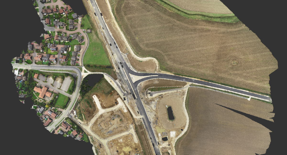
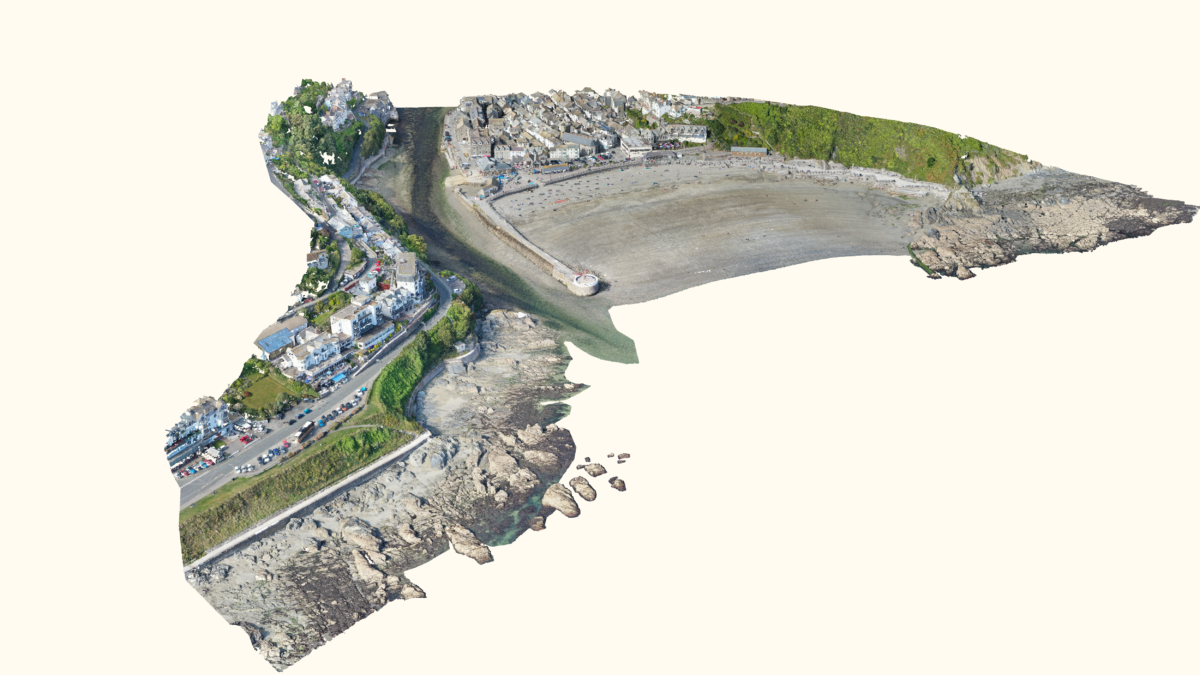
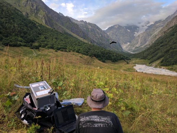
With the ability to rapidly cover large areas and access hard-to-reach locations, a UAV / Drone survey offers a cost-effective and safe solution for a range of surveys and inspections. The top-down perspective will often inform where terrestrial systems may be limited, providing the best possible data augmentation to the more traditional ground-based systems.
LandScope operates advanced sensor technology to deliver high-resolution aerial survey data, across a wide array of sectors, including:
- Aerial LiDAR / Laser scanning
- Multi-spectral imaging
- High resolution aerial photography
- Geophysical data acquisition – Magnetometry and GPR
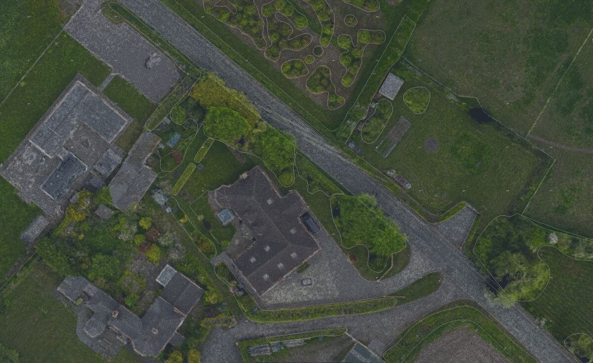
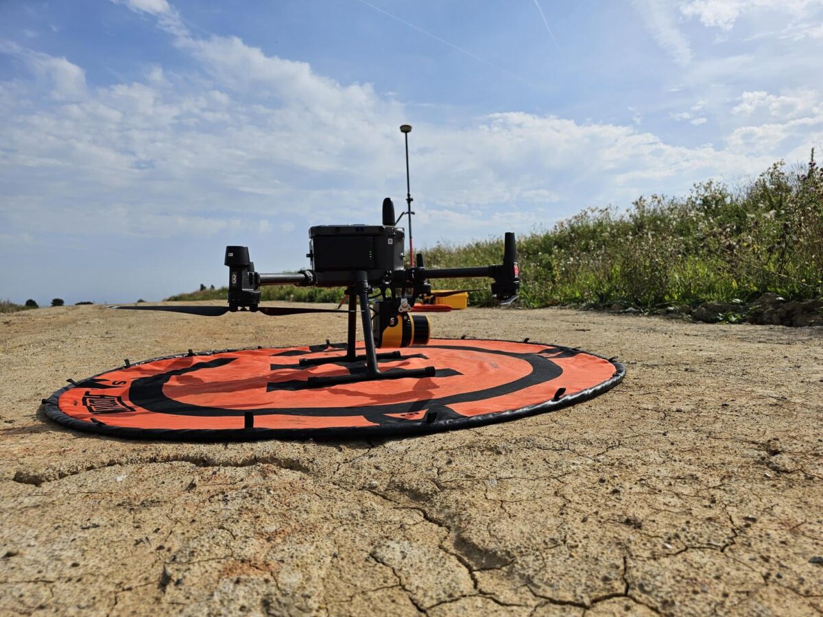
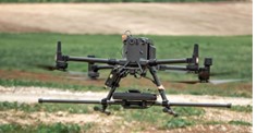
Our Unmanned Aerial Vehicle (UAV) fleet includes both fixed-wing and multi-rotor systems which will be selected by our experienced CAA approved team depending on the survey area and objective. A single UAV / Drone survey campaign may be designed for the creation of topographical models / DTMs, visualisations, volume calculation and analysis, monitoring, and asset inspection.
DRONE SURVEY AND INSPECTION
We offer a comprehensive drone survey and inspection service using Unmanned Aerial Vehicles (UAVs). LandScope operates in-house fixed-wing and multi-rotor UAV systems. All campaigns are designed and supervised by our CAA accredited and in-house trained pilots.
A drone survey enables large areas to be mapped at a fraction of the time and cost of traditional methods, and the technology is now a proven and common tool in the surveyor’s arsenal.
SURVEY ACCURACY
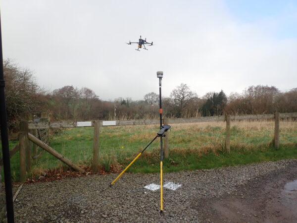
We specialise in the delivery of survey accuracy as part of the UAV survey delivery. Each survey campaign will be designed with 3D survey accuracy as the core principle. Onboard real-time positioning and attitude sensors (IMUs) will be rigorously checked against ground control and terrestrially derived survey data subsets to provide our customers with the highest dataset confidence.
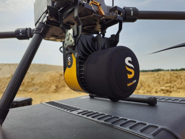
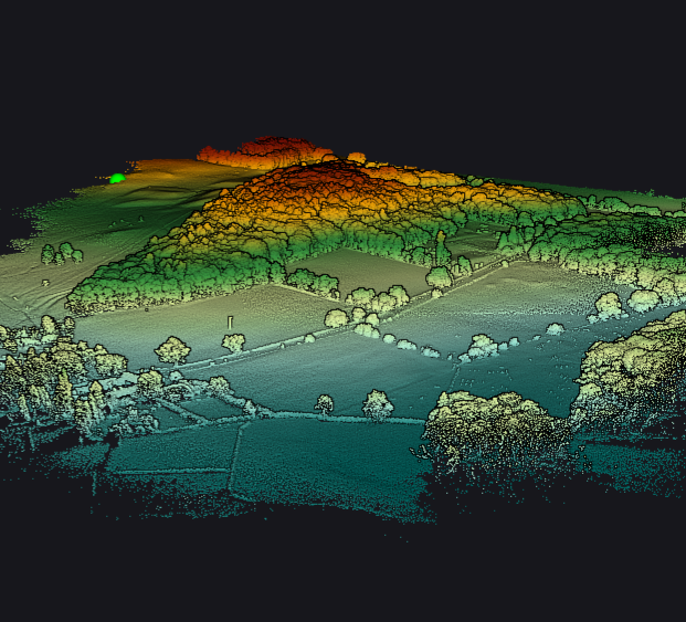
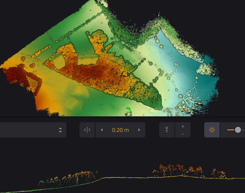
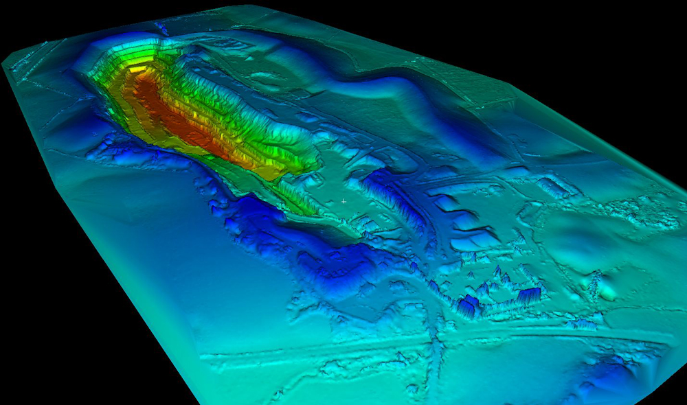
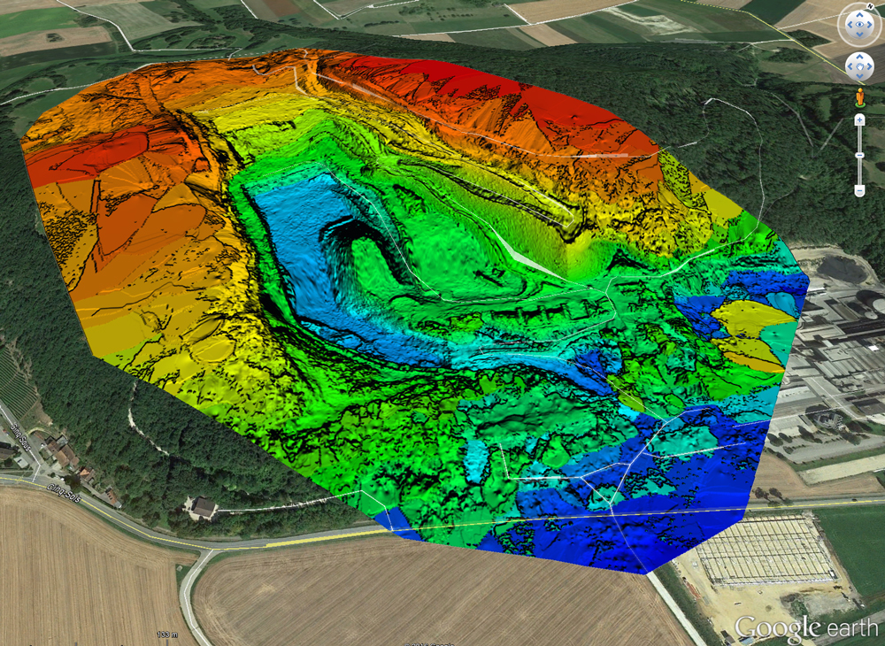
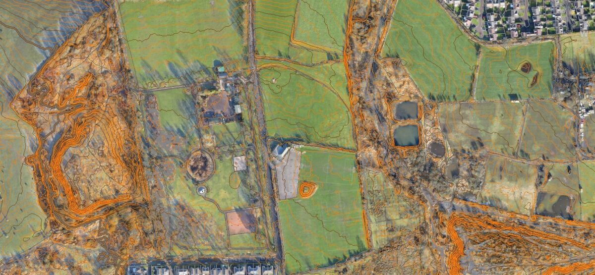
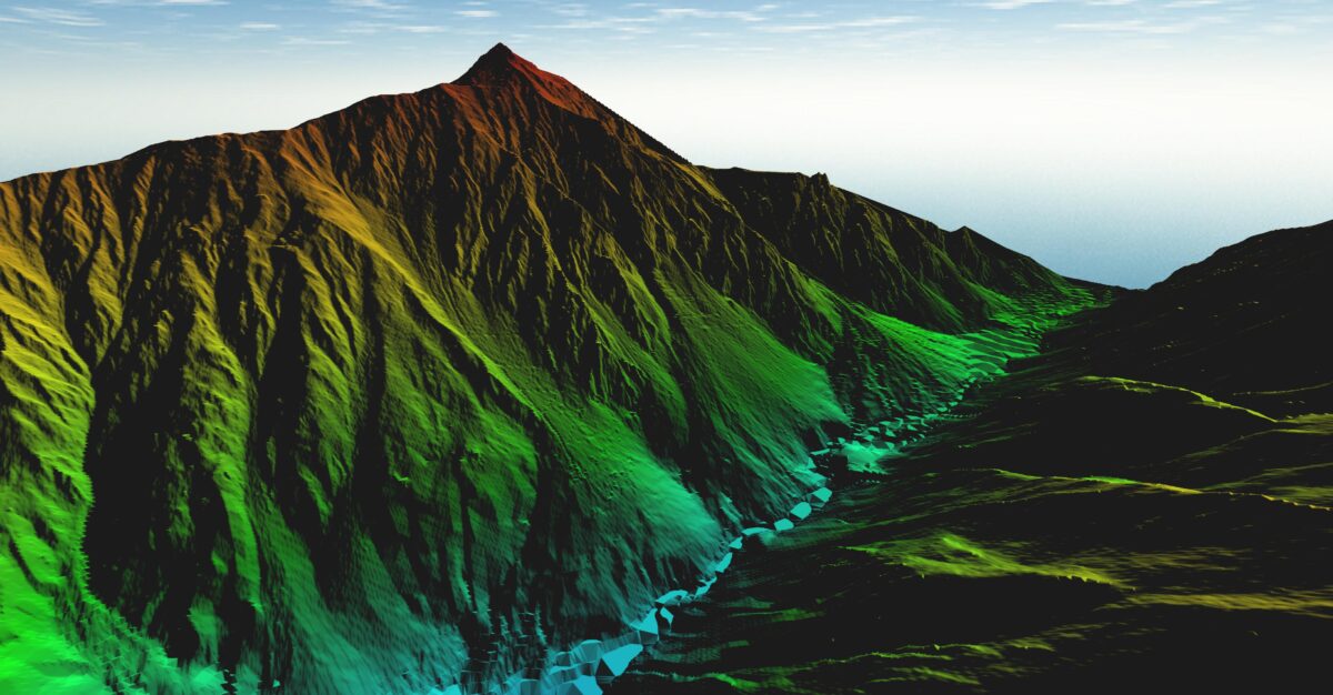
AERIAL LiDAR
Our YellowScan Mapper is an integrated LiDAR solution offering a real-time kinematic GNSS-aided IMU trajectory solution and a 360-degree scan field of view laser scanner. The 3D platform positioning is of exceptional quality which supports well the superlative range and noise performance of the LiDAR sensor.
Advanced data processing techniques facilitate the differentiation between LiDAR-derived surface and ground models – ensuring our topographical and digital terrain models are accurately represented.
SENSOR CONFIGURED
UAV survey payloads may incorporate a wide array of sensors to provide bespoke survey design. The incorporation of multi-spectral and thermal imaging or the integration of geophysical sensors including magnetometry and ground penetrating radar (GPR) are all possible with robust survey planning, design, and execution.
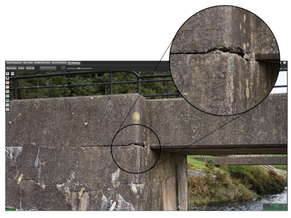
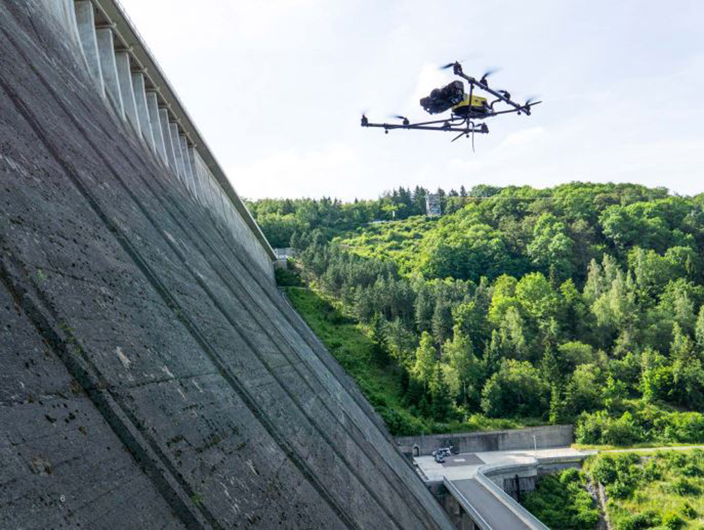
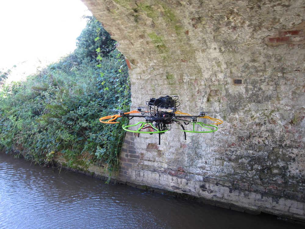
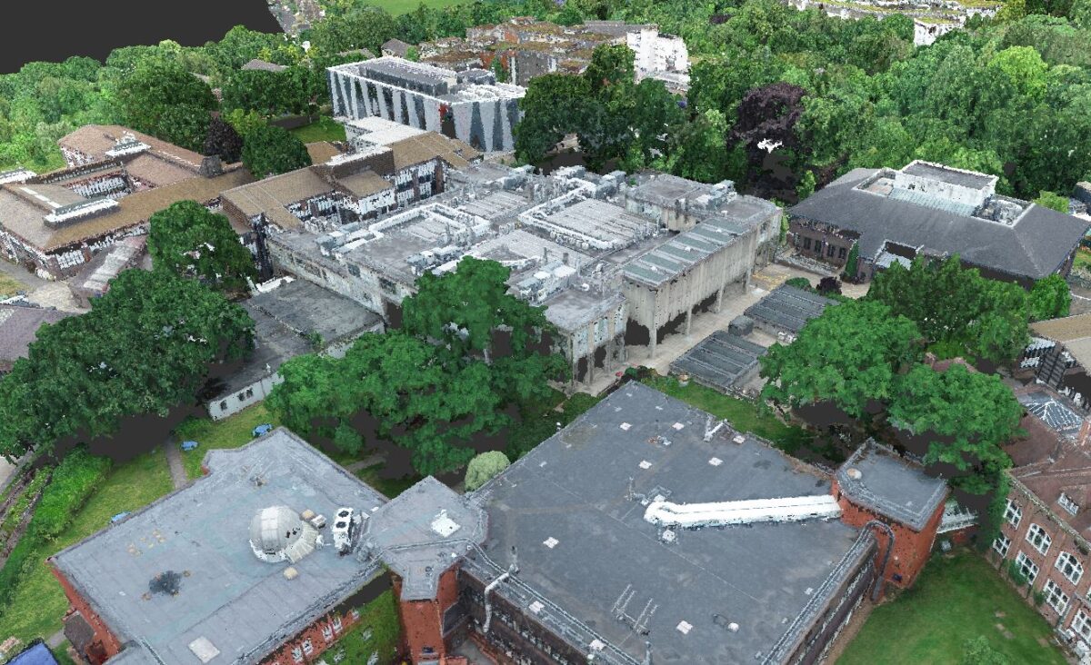
INSPECTION AND MONITORING
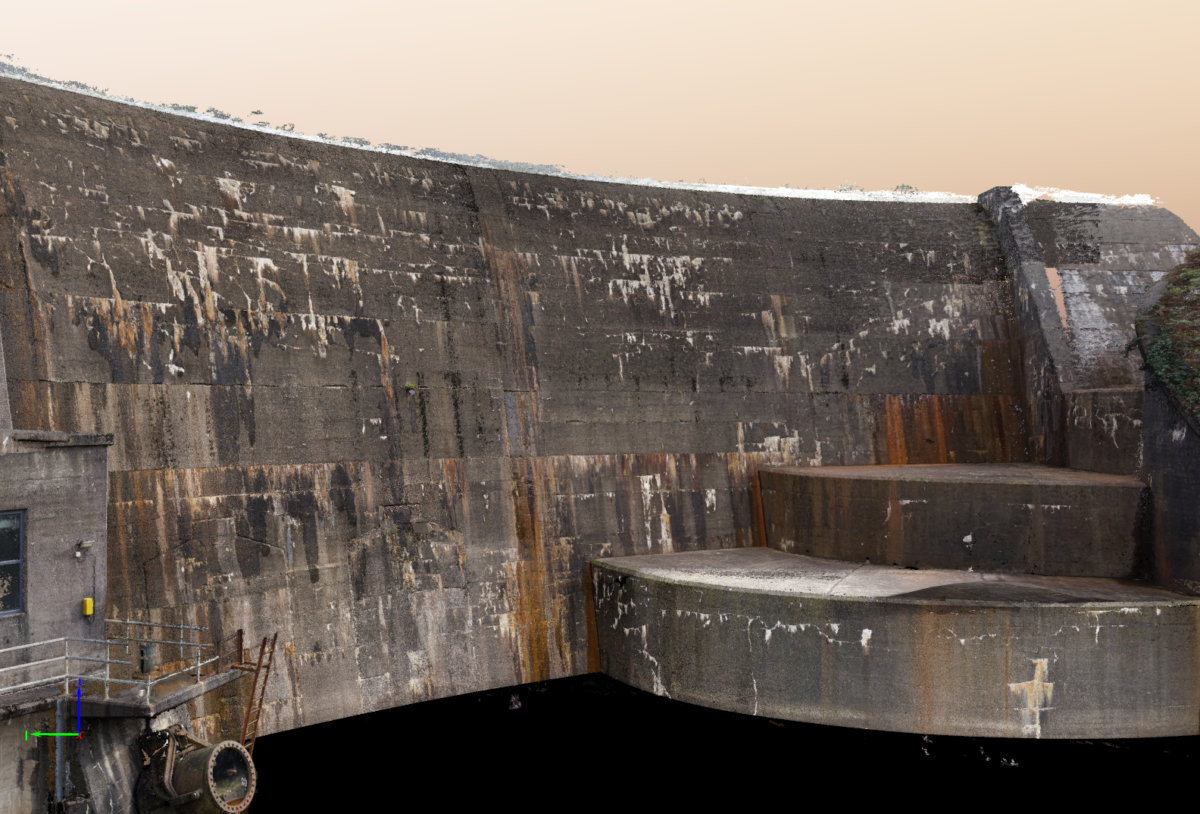
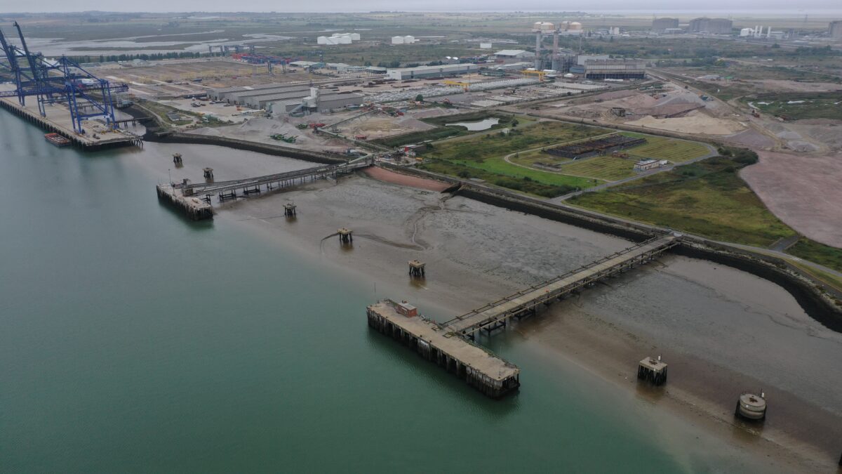
LandScope have developed a bespoke solution for the inspection and visualisation of structures located in challenging or difficult to access areas. Our UAV systems capture close-range, high-resolution images and is ideally suited for the underside of bridges and dam faces. The system provides an accurate and safe alternative to extensive scaffolding, work platforms or rope access.
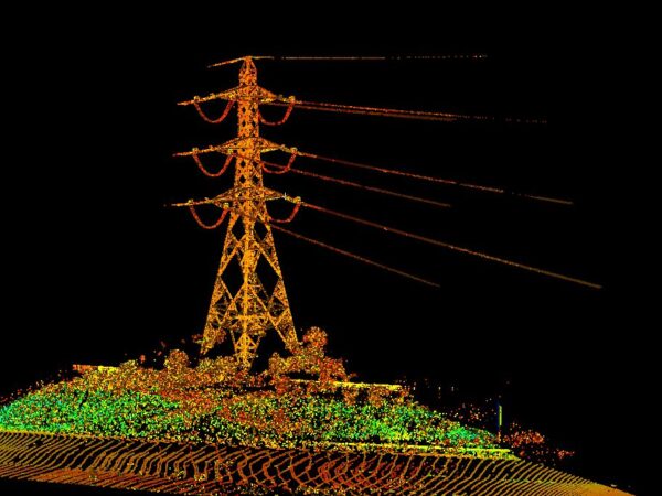
GS6 SURVEYS
LandScope has an array of survey equipment (non-contact measuring equipment) that can rapidly and accurately map overhead line infrastructure and the terrain below.
This is includes; LIDAR and imagery collected via UAV/drones, vehicle mounted mobile mapping and terrestrial hand portable systems.
Data can be collected and provided in raw point cloud format or heights, ground terrain, obstructions, and vegetation etc can be extracted and provided as models or drawings.
APPLICATIONS INCLUDE:
- Topographical survey
- Mapping of large-scale proposed routes including pipeline, overhead cable, and highway feasibility
- Quarry and stockpile survey
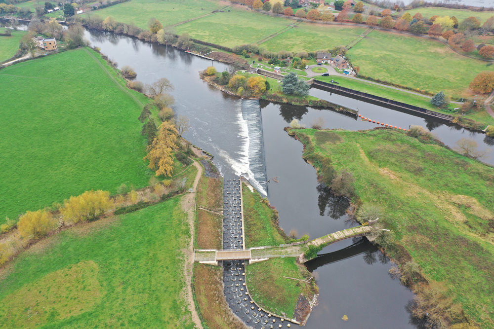
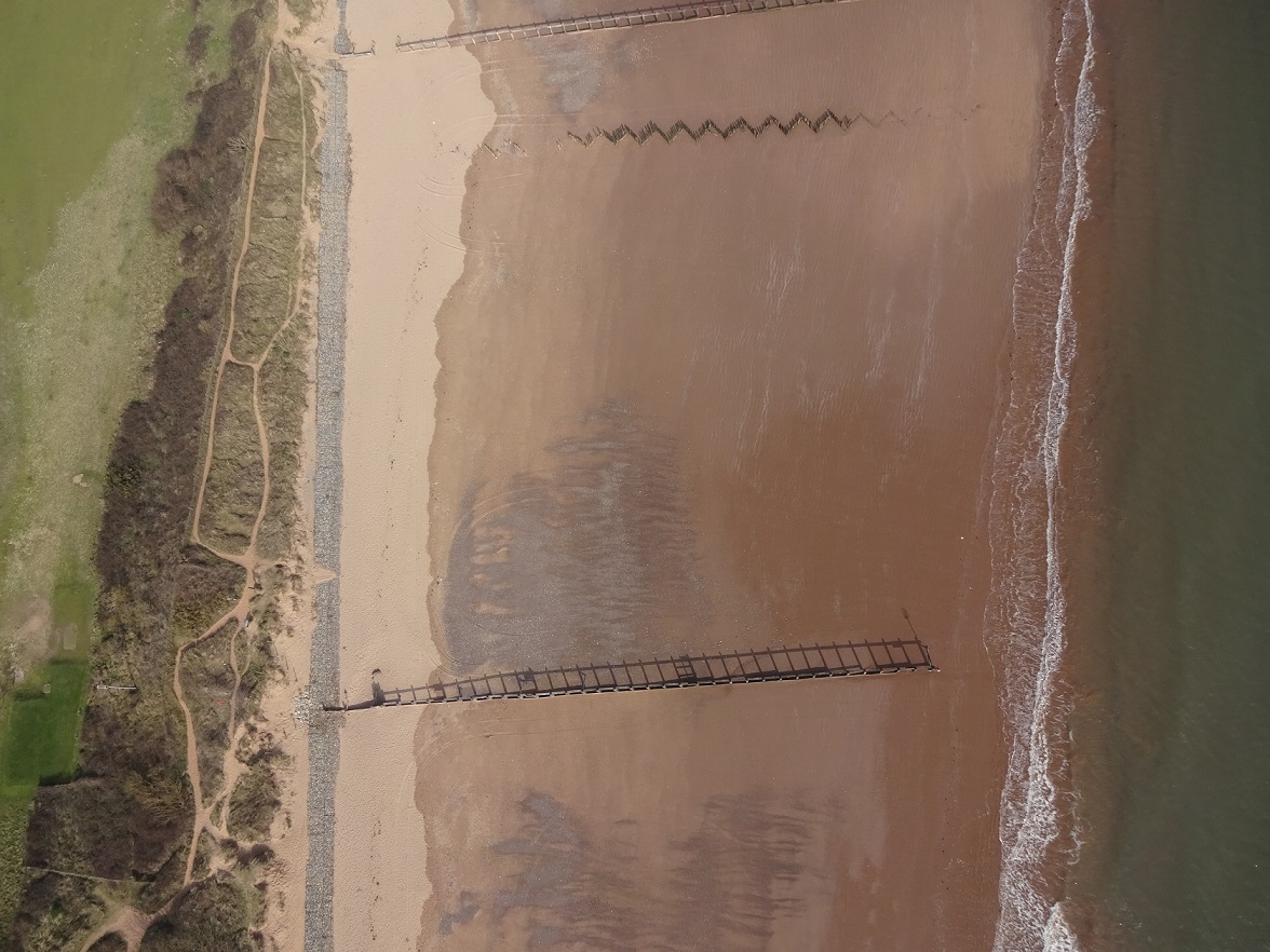
- Inspection of weirs, bridges, dams, and other marine infrastructure
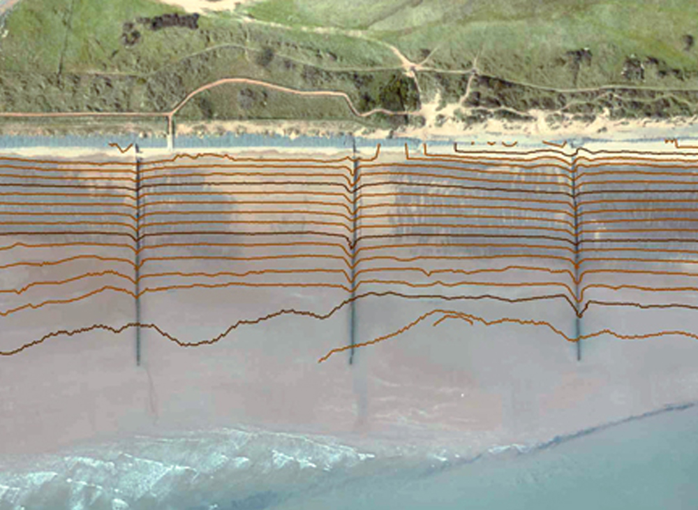
- River and coastal modelling
- Flood risk assessment and modelling