Mobile Solutions
Vehicle Platform
LandScope Engineering have been providing vehicle-based mobile mapping services since 2010. As an early entrant we have established the highest quality acquisition work-flows and have developed a superlative level of 3D data accuracy. We recognise that mobile mapping is not the panacea to all survey requirements and therefore will often design programmes to integrate other traditional survey instrumentation in order to provide independent check and technical certainty whilst retaining the incredible efficiency gains from the mobile mapping approach.
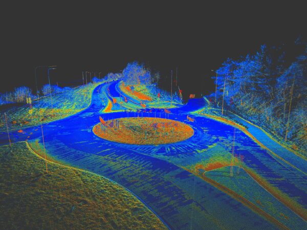
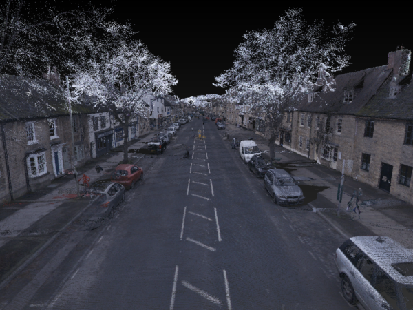
Simultaneously capturing high-resolution panoramic imagery and high-density point cloud, the resultant data outputs have wide-ranging applications including the production of topographical models, visual impact assessments, remote site visualisation and asset management.
HIGHWAYS
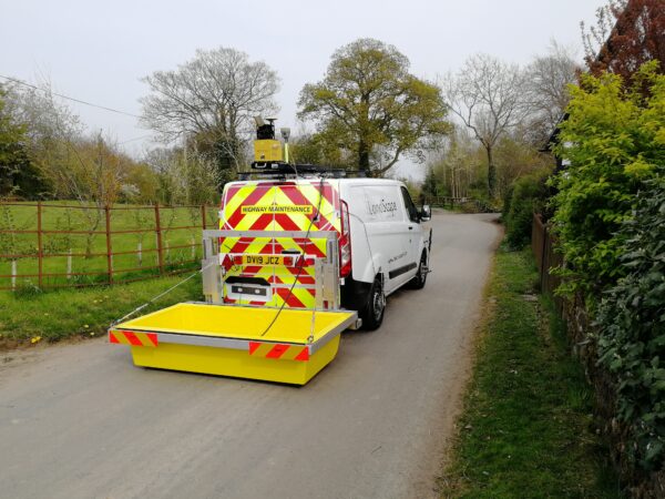
With our bespoke chapter 8 compliant Highway Survey Vehicle (HSV), rapid acquisition of mobile mapping data within the highway environment is safely achieved at highway speeds. The HSV reduces the requirement for costly traffic management and in most cases removes it altogether reducing scheme planning, approval delays and costs. Our HSV is driven by our surveyors who all hold advanced driver certification ensuring the vehicle is always operated in the safest manner within the public realm.
The HSV is easily interfaced with our ground penetrating radar system from Kontur (formerly 3D-Radar), offering geo-referenced sub-surface imaging and fully adjustable pavement camera solutions for high-resolution imagery over areas of particular interest.
OTHER ENVIRONMENTS
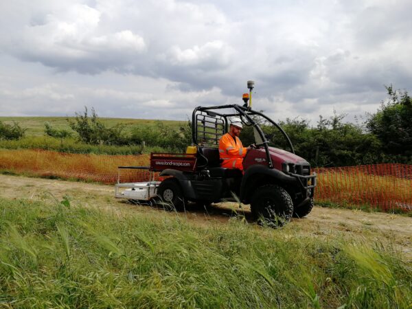
In addition to our Highways Survey Vehicle, our portable mobile mapping systems can be deployed from various survey platforms for mapping of all environments.
Off-Road: our fleet of all-terrain vehicles (ATV) are used for remote or inaccessible environments.

WHAT BENEFITS CAN MOBILE MAPPING OFFER YOUR PROJECT?
Mobile mapping offers a number of advantages over traditional survey methods, including:
Safety: removing survey personnel from high-risk environments
Speed: enormous productivity gains
Accuracy: extraordinary levels of absolute and relative accuracy of data
Resolution: 24MP 360 degree camera and up to 1 million points per second of LiDAR
Scalability: options for integration with multiple sensors including GPR and pavement camera systems
Versatility: ability to host from multiple platforms
INTEGRATE WITH MOBILE GPR TO SEE ABOVE AND BELOW GROUND
The Mobile GPR system is positioned as standard by GNSS and odometer. For more challenging environments including city centres, tree lined roads and embankments, this can be augmented with the more accurate trajectory of a mobile mapping system.
Simultaneously operating the mobile ground penetrating radar and mobile mapping systems offers a single pass solution to capture highway infrastructure above and below ground.
Click on the button below to find out more about Mobile GPR.
APPLICATIONS OF MOBILE MAPPING
- Topographical Survey
- Digital Twin Modelling/BIM
- Route Alignment Surveys
- Remote Site Visualisation
- Asset Management – Inventory and Condition
- Utility Record Surveys
- Site Condition Recording