5km Sewer Pipeline Route Survey
5km Sewer Pipeline Route Survey
Integrated Topographical, PAS128 Utility Survey, UAV LiDAR & Mobile Mapping
A major UK water company required survey-grade geospatial data to support the planning and design of a new 5km sewer pipeline through highways, farmland and complex infrastructure.
Integrated Topographical, PAS128 Utility Survey, UAV LiDAR & Mobile Mapping
The Challenge
Planning a new sewer pipeline across a 5km corridor presented numerous technical and logistical challenges.
The proposed route crossed busy highways, agricultural land, active construction sites and multiple river crossings, while also navigating overhead powerlines and underground utilities.
The project required:
- PAS128 utility surveys through highway sections
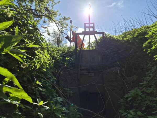
- Surveying around overhead power infrastructure
- Multiple river crossings
- Landowner and farmer liaison
- Crop protection
- Access through active construction sites
- Safe working adjacent to live traffic
- Delivery of one coordinated dataset for designers
No single survey technique could efficiently capture every environment, making an integrated approach essential.
Our Solution
LandScope designed a fit-for-purpose survey strategy, selecting the right technology for each environment.
UAV LiDAR
Large areas of farmland and inaccessible terrain were surveyed using UAV LiDAR and aerial imagery, providing rapid, high-density topographical data while minimising disruption to crops and landowners.
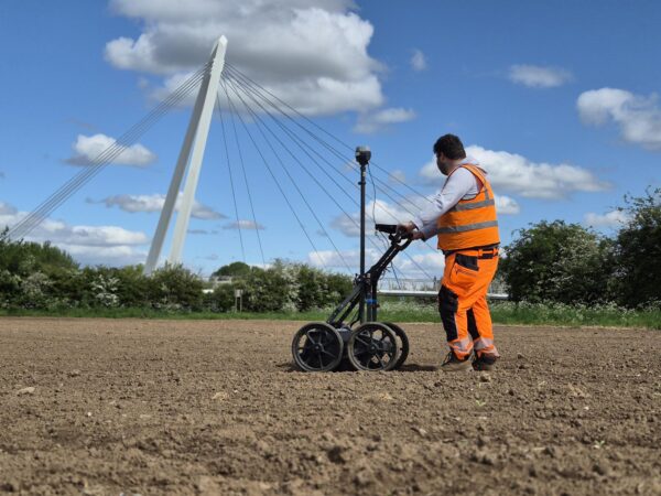
PAS128 Utility Survey
Highway and sections were surveyed using Ground Penetrating Radar (GPR) and Electromagnetic Location (EML) techniques in accordance with PAS128, with all findings reconciled against statutory utility records.
Mobile Mapping
Road corridors were captured using mobile mapping technology, significantly reducing traffic management requirements while collecting survey-grade data safely and efficiently.
Topographical Surveys • PAS128 Utility Mapping • UAV LiDAR • Mobile Mapping
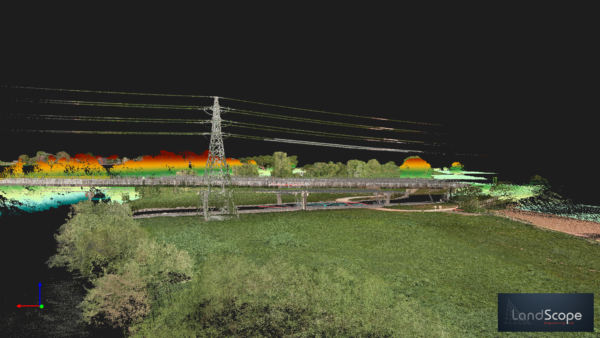
Infrastructure within pipeline corridor
Planning & Delivery
The success of the project relied on careful planning and creating a ‘Fit for Purpose’ survey strategy.
Our team:
- Planned UAV flight operations around site constraints
- Coordinated access with multiple farmers and landowners
- Liaised with construction teams throughout the programme
- Developed robust Safe Systems of Work
- Planned and managed traffic management requirements
- Reported daily progress and site constraints
- Adapted survey activities as access conditions changed
This proactive approach ensured survey activities progressed safely and efficiently across a complex linear infrastructure project.
Deliverables
The completed dataset provided a single source of truth for designers and project stakeholders.
Deliverables included:
- Topographical CAD survey
- PAS128 utility survey
- Reconciled statutory utility information
- High-density point cloud
- GIS-ready datasets
- UAV imagery
- Integrated survey model across the full corridor
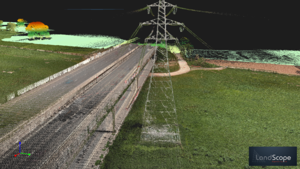
Infrastructure pointcloud data
The Outcome
By combining UAV LiDAR, PAS128 utility surveying and mobile mapping, LandScope delivered a coordinated geospatial dataset that enabled informed design decisions across the entire pipeline route.
The project reduced design uncertainty, improved collaboration between stakeholders and provided the trusted data needed to progress the scheme with confidence.
Technologies
- UAV LiDAR
- PAS128 Utility Survey
- Ground Penetrating Radar (GPR)
- Electromagnetic Location (EML)
- Mobile Mapping
- GIS
- Point Cloud
- CAD
Planning a Linear Infrastructure Project?
Whether you’re designing a new pipeline, utility corridor or transport scheme, LandScope delivers integrated survey solutions that reduce risk, improve safety and provide reliable geospatial data from the outset.
Contact our team to discuss your project.