Mobile Mapping & Mobile GPR Survey – 9km London Highway Corridor
Mobile Mapping & Mobile GPR Survey
Integrated Above and Below Ground Survey for Smarter Route Planning
Planning new infrastructure through a busy urban highway requires more than accurate survey data. Designers need confidence that they can identify the most efficient route, minimise clashes with existing buried services and reduce unnecessary construction costs before work begins.
LandScope Engineering was appointed to deliver an integrated above and below ground survey across more than 9km of heavily trafficked London highway, combining Mobile Mapping with Mobile Ground Penetrating Radar (Mobile GPR).
The resulting dataset enabled the design team to assess existing highway features alongside buried utilities, helping identify the most suitable route for a proposed service installation while reducing the potential for costly utility diversions, programme delays and construction risk.
By capturing survey-grade data without traffic management and completing mobile data collection during overnight shifts, the project delivered significant programme, cost and safety benefits while minimising disruption to the travelling public.
The Challenge
The proposed route passed through one of London’s busiest road corridors, creating significant operational and logistical challenges.
The survey corridor included:
- High traffic volumes
- Multiple bus routes and bus stops
- Parked vehicles restricting access
- Signal-controlled junctions
- Numerous stakeholders, including Transport for London (TfL)
- Limited opportunities for conventional survey access
- A requirement to minimise disruption to road users and local businesses
The project required accurate information both above and below ground so the design team could identify the preferred route while avoiding unnecessary clashes with existing underground infrastructure.
Traditional survey techniques would have required extensive traffic management, lane closures and prolonged occupation of the highway, increasing costs and disruption.
Delivering Commercial Value Before Construction Begins
For linear infrastructure projects, understanding existing constraints as early as possible has a direct commercial impact.
Rather than relying solely on statutory utility records or commissioning separate survey packages, LandScope delivered an integrated digital representation of the entire corridor that allowed designers to evaluate potential routes with greater confidence.
This approach helped:
- Reduce the likelihood of unnecessary utility diversions
- Minimise future excavation risk
- Improve route selection during design
- Reduce uncertainty before construction
- Increase confidence in project budgeting
- Support faster engineering decisions
- Reduce disruption across a busy urban environment
The result was not simply a survey, but a comprehensive dataset that enabled better engineering decisions before construction began.
The Solution
LandScope designed an integrated survey methodology combining Mobile Mapping, Mobile GPR and precise survey control.
Mobile Mapping Survey
Vehicle-mounted laser scanning and imaging systems captured detailed topographical information including:
- High-density point cloud data
- Kerb lines
- Carriageway geometry
- Footways
- Street furniture
- Highway assets
- Road markings
- Surface features
- Existing infrastructure
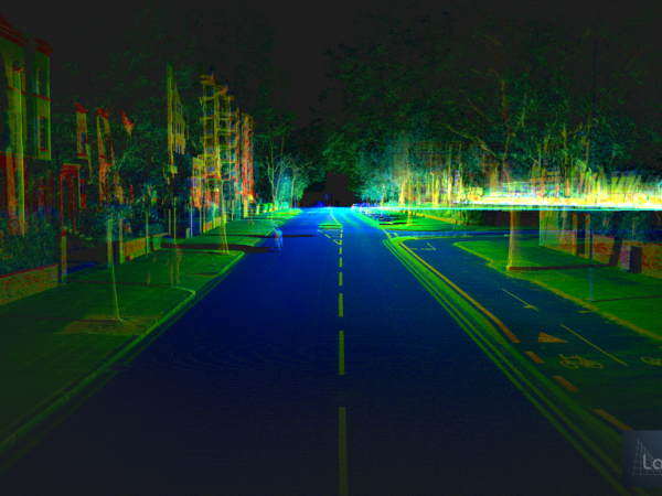
The mobile mapping survey delivered a complete digital representation of the highway corridor, providing designers with accurate spatial information for design and coordination.
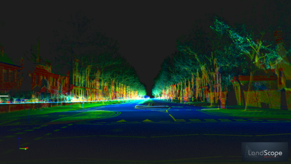
High-density mobile mapping point cloud
Mobile Ground Penetrating Radar (Mobile GPR)
Simultaneously, vehicle-mounted Ground Penetrating Radar was used to collect subsurface information throughout the highway carriageway.
The Mobile GPR data was reconciled against statutory utility records to improve confidence in the location of existing buried services and support informed route selection.
Combining both datasets produced a coordinated understanding of the environment above and below ground within a single survey programme.
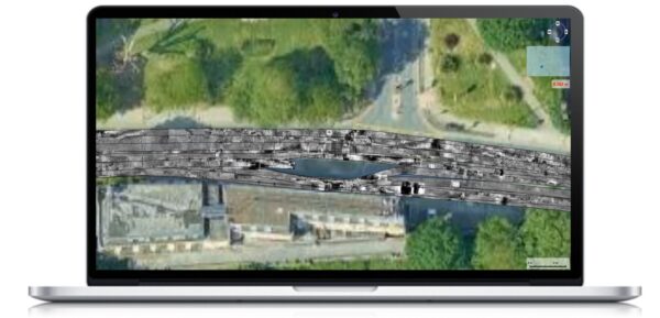
GPR data showing a slice of data 162mm below the surface
Survey Control and Quality Assurance
To support survey-grade accuracy, verification control points were installed during daytime working using RTK GNSS before the night survey commenced.
These pre-established survey control points allowed verification of the mobile mapping trajectory throughout the overnight data collection programme, ensuring the accuracy and reliability of the final deliverables.
Safe Data Capture with Minimal Disruption
The survey was completed during overnight shifts when traffic volumes were significantly lower.
Using vehicle-mounted survey technology enabled LandScope to capture both topographical and utility data while remaining within live traffic, removing the need for conventional traffic management.
This approach delivered significant commercial and operational benefits, including:
- No traffic management required
- No lane closures
- No road closures
- Reduced traffic management costs
- Minimal disruption to road users
- Reduced exposure of survey personnel to live traffic
- 60%+ programme savings compared with conventional survey methods
- 50%+ reduction in project carbon through reduced site occupation and fewer repeat visits
By integrating multiple survey technologies into a single mobilisation, LandScope reduced programme duration while improving both safety and efficiency.
Results
The integrated survey successfully delivered:
- Over 9 kilometres of surveyed highway
- Complete kerb-to-kerb topographical survey
- High-density mobile mapping point cloud
- Mobile GPR utility detection throughout the carriageway
- Utility reconciliation against statutory utility records
- Survey control verification across the entire corridor
- Comprehensive digital data for design development
The completed survey enabled the design team to identify the preferred route for the proposed service while reducing uncertainty around existing buried infrastructure.
Providing accurate, survey-grade information early in the design process helped reduce the likelihood of unnecessary utility diversions, improve programme certainty and minimise construction risk before work commenced on site.
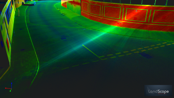
High-density mobile mapping point cloud showing a busy London highway corridor surveyed without traffic management.

High-density mobile mapping point cloud showing assets and road markings
Why Integrated Mobile Mapping and Mobile GPR?
Infrastructure projects increasingly require more than individual survey deliverables.
By combining Topographical Survey, Mobile Mapping and Mobile Ground Penetrating Radar within a single coordinated survey programme, LandScope provides one trusted dataset that supports planning, design and delivery.
This integrated approach helps clients:
- Make faster engineering decisions
- Improve route planning
- Reduce design iterations
- Improve utility coordination
- Reduce project risk
- Lower construction costs
- Minimise disruption to stakeholders
- Reduce carbon associated with repeat site visits
- Improve collaboration through shared digital information
For designers, contractors and asset owners, this means better decisions can be made earlier, when they have the greatest commercial impact.
Conclusion
For complex urban infrastructure projects, the quality of early survey information has a direct impact on programme, cost and risk.
By integrating Mobile Mapping, Mobile Ground Penetrating Radar (GPR) and precise survey control, LandScope Engineering delivered a comprehensive digital model of more than 9km of busy London highway without the need for traffic management.
The survey provided designers with a trusted understanding of both the visible highway environment and the buried utility network, enabling informed route selection, reducing uncertainty and helping avoid unnecessary utility diversions before construction began.
This project demonstrates how integrated geospatial data can accelerate design, improve safety, reduce disruption and create measurable commercial value throughout the infrastructure lifecycle.