Bridge Replacement Survey
Project overview
LandScope Engineering completed a bridge replacement survey over a busy dual carriageway. The client needed accurate information about the existing bridge, surrounding highway and nearby utilities to support the replacement design.
Our team combined 3D laser scanning, PAS 128 utility surveying and Revit modelling to provide a complete record of the site.
The challenge
The dual carriageway carries high volumes of traffic. Therefore, daytime access was not possible.
Instead, our team worked under traffic management during a planned overnight road closure. This provided a limited window to complete the work safely.
Several important utilities also needed to be located. These included BT services, drainage and an oil pipeline. Careful planning was essential to capture all the required information before the road reopened.
Our survey solution
We used 3D laser scanning to capture the bridge, surrounding highway and key structural features. This technology allowed our surveyors to collect detailed information quickly within the available closure.
At the same time, our utility specialists completed a survey in accordance with PAS 128. The survey identified and mapped the BT services, drainage network and oil pipeline around the bridge.
By combining both survey methods, we captured detailed above-ground and below-ground information during the same night shift.
Point cloud and Revit model
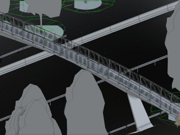
We processed the laser scanning data to create a registered 3D point cloud. Our modelling team then used this information to produce an accurate Revit model of the bridge and its surroundings.
The deliverables included:
- Registered 3D point cloud
- Accurate Revit model
- PAS 128 utility survey
- BT, drainage and oil pipeline locations
- Existing structural and highway details
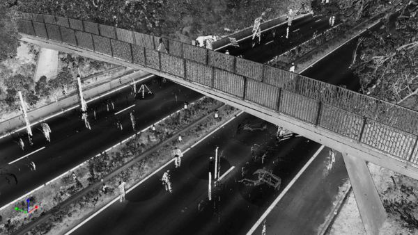
Laser scanning and PAS 128 utility surveying completed under traffic management during an overnight road closure.
The outcome
The completed bridge replacement survey gave the design team a reliable record of the structure, surrounding highway and key utilities.
This information supported the replacement design and highlighted potential risks before construction. Furthermore, completing the work within the planned closure reduced the need for further site visits and additional traffic management.
By combining careful planning, rapid data capture and experienced survey teams, LandScope delivered the required information safely and with minimal disruption.
Planning a bridge replacement? Contact LandScope Engineering to discuss laser scanning, PAS 128 utility surveys and Revit modelling.
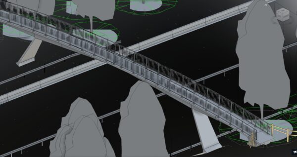
Revit Model of the bridge.