LandScope Deploys Latest Technology to Building Modelling (BIM) Project
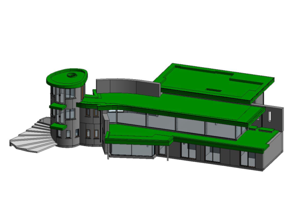
LandScope have recently provided an as-built survey of a complex two storey house overlooking the mouth of the River Fal estuary in Cornwall. The scope included the provision of detailed 2D drawings, a colourised point cloud, and a 3D Revit model.
Real world positioning was provided via an R12i system – the latest and most accurate GNSS sensor from Trimble.
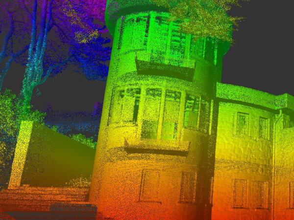
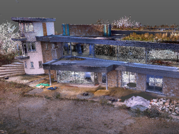
Building scanning (3D point cloud survey) was completed with a combination of Trimble SX10 and Trimble X7 laser scanners. The Trimble SX10 has the advantage of operating as a total station and a laser scanner, enabling the establishment of site control framework. The Trimble X7 is small and incredibly quick, capturing high density point cloud combined with high-resolution HDR (high dynamic range) photography. The photography was critical to the site works, as it provided a useful dataset not only to the LandScope modelling team but also to the client.
Survey data is quality checked at site to ensure sufficient detail has been captured. The advantage of using the Trimble X7 is that the point cloud leaves site provisionally registered, increasing technical certainty and substantially reducing the office processing workload.
The LandScope modelling team use a combination of point cloud and photography to compile accurate floor plans and elevations as well as create the 3D model in Revit. The resultant as-built digital twin of the partially complete house will ensure the developers complete construction with confidence.
If you would like more information on any of our measured building and 3D survey solutions, please contact our commercial team on 01694 731930 or enquiries@land-scope.com.