U-GIS, LandScope’s Underground GIS Platform
As utility mapping techniques evolve and mapping standards improve the need for a more dynamic data delivery platform is rapidly developing within the utility industry.
There will always be a requirement for the traditional delivery packages such as AutoCAD/Microstation/PDF etc. These are required for accurate design and modelling. However, not everyone has access to these expensive software packages, and they often only enable you to view a small sub-set of file types.
At the point of delivery in these traditional survey packages, the costly site work and processing has been completed. For a small fee, your data can be re-purposed and collated into a single geographical interface such as Orbit GT.
The advantages are as follows:
- Data is associated with its positional/location and stored in a behind the scenes data base. For example, if you click on a pipe you can find out its material / diameter etc. If you click on a manhole you can view the manhole card (EUFR) and associated data.
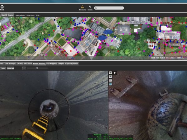
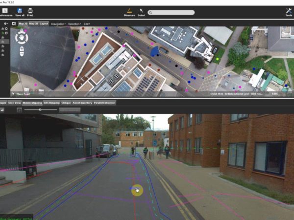
- The package can include other data sets such as point clouds, 360-degree street view imagery and 360-degree manhole photography (see images below). All of this adds up to a very powerful visualisation tool which is made up of multiple data sets that would have previously been stored in multiple locations and in multiple formats. Why not bring everything together, in one place, within one software package that can be accessible to all.
- The Orbit GT GIS software package offers a cloud solution which can be accessed by anyone within the organisation through a web browser. No expensive software or IT hardware requirements. Simply share a web URL to allow access to the data. Have a look for yourself, we have sample data sets for various environments (highways, rail and marine) available to access on our website: 3D Mapping Cloud Demo