UAV Proves an Invaluable Inspection Tool to Capture As-Built Record of Dam Face
LandScope now uses its UAV / drone fleet to provide unprecedented levels of inspection and survey of customer’s hard-to-reach infrastructure assets. Elevations and undersides of bridges, overhead pylons and structures, marine navigation aids etc., are all now easy-to-reach.
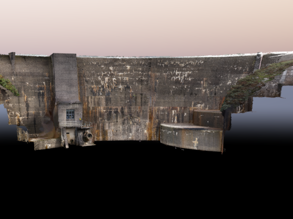
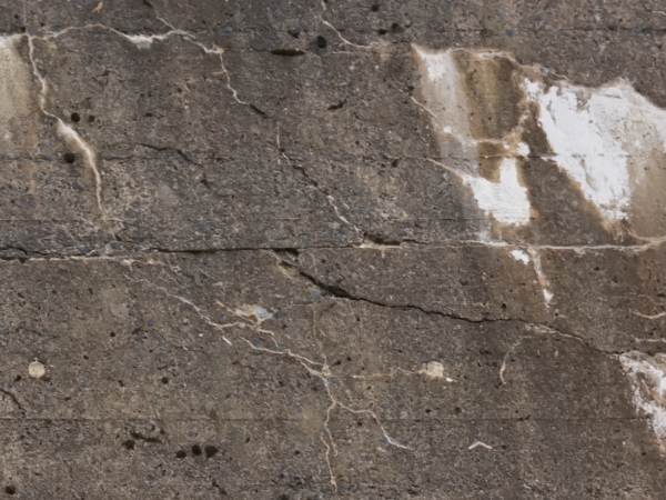
As part of ongoing structural monitoring of hydroelectric dams in mid-Wales, LandScope provided a high resolution condition record of the dam structures. The highest resolution photographic record imagery was acquired over the dam wall face with a quadcopter UAV, removing the traditional need for installation of temporary scaffolding or deployment of rope teams.
The UAV was launched from an adjacent grass bank and flown circa 5m from the dam face with a 36MP camera and 50mm fixed focal length lens. The flight took approximately 40 minutes, capturing high resolution photography and point cloud data of the structure. In addition to the UAV survey, the face of the dam was laser scanned using a Trimble TX8.
The resultant data was post processed in Pix4D, producing a series of georeferenced images as individual images and as an Orthomosaic. The UAV point cloud was also combined with the laser scan point cloud to produce a complete and highly accurate 3D model of the dam face.
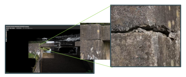
The data was delivered to our client online via Orbit 3DM Cloud from Bentley Systems. Within 3DM Cloud, our client can zoom to specific areas of interest to take measurements as well as add annotations. The combination of the data, and the delivery mechanism, ensured the client received a highly detailed as-built record of the structure which could be readily viewed from the safety of the office.
If you would like more information on any of our drone survey and inspection solutions, please contact our commercial team on 01694 731930 or enquiries@land-scope.com.