GROUND PENETRATING
RADAR
In recent years, ground penetrating radar (GPR) has developed into a powerful tool for utility detection and buried obstruction mapping. GPR technology is rapidly evolving and significant developments have taken place over the last few years to allow for higher quality data (improved detection rates), advanced positioning (centimetre accuracy) and modular/vehicle-mounted systems (faster more versatile collection). Applications for ground penetrating radar surveys range from traditional geophysical deployment to infrastructure and transportation sectors.
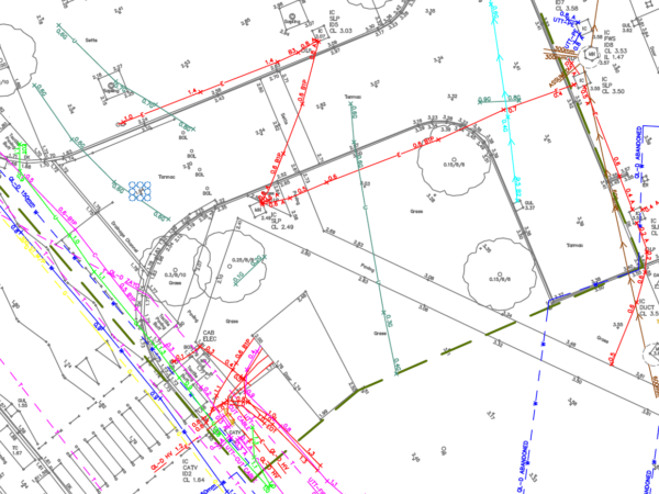
Sophisticated post-processing software packages now afford the highest levels of detection with optimisation of processing time. Results from GPR surveys can be directly picked onto the utility mapping line work and exported into numerous formats to include GIS and 3D CAD models.
HOW DOES GPR WORK?
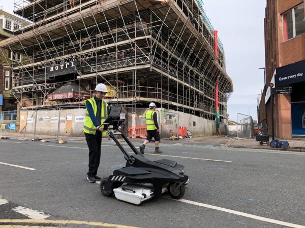
Ground-penetrating radar (GPR) works by sending a radio signal, or series of signals, into the ground to provide information on ground characteristics. This information is interpreted by the returning / reflected signals from sub-surface structures.
The main advantage of a GPR survey is that it is neither invasive nor destructive and can detect both metallic and non-metallic materials.
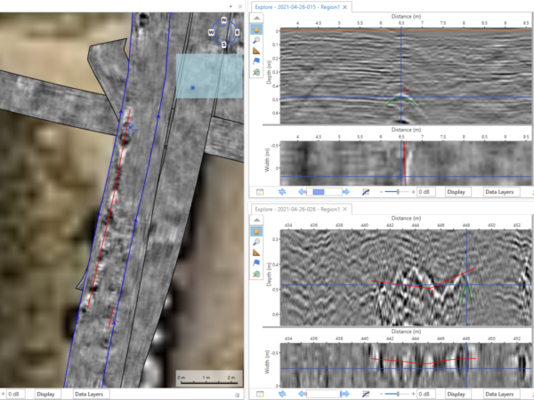
GROUND PENETRATING SURVEY POST PROCESSING
LandScope integrates the latest technologies to provide detailed post-processed GPR surveys. Our team of in-house geophysicists are experts in producing clear and accurate representations using all the information obtained during projects. This can include;
- Underground utility mapping, location and characterisation of non-metallic services such as plastic mains and fibre optic cables
- Void location, sub-structure location, bedrock assessment, trench location, geophysical surveys, concrete inspections, ballast condition, rebar analysis, planar surfaces and changes in material properties
COMPREHENSIVE GPR SURVEY RESULTS
LandScope integrates a wide range of innovative GPR equipment and software to achieve the most comprehensive survey results. It is an integral part of our service because it allows us to assess the depth and position of all buried services (including non-metallic services). It also allows us to see the exact locations of any voids, trenches, cracks and sub-structures without the need for intrusive works.