When Nature Acts, LandScope Reacts
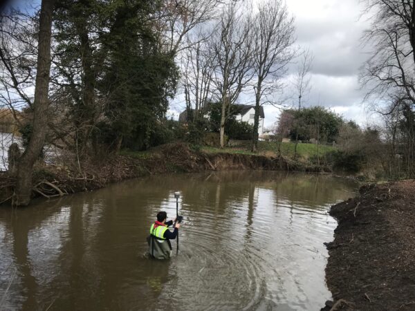
A client got in touch regarding a brook they are responsible for in an area at high risk of flooding. Serious erosion of a bank was leading to scour and the formation of a deep pool. We were asked to establish the depth of the pool and surrounding area. In liaison with the client the hydrographic team conducted an in-depth risk assessment and method statement (RAMS), then when the weather window was appropriate they hunted out the waders and headed off to site.
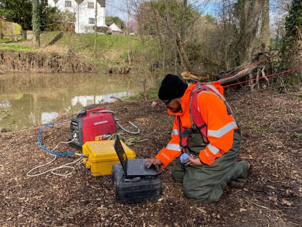
With safety planning and rescue measures in place, a bank-to-bank rope system was established to deploy the Teledyne Blueview scanning sonar into the pool. To augment and assure the quality of the data, our brave colleague then ventured out into the chilly Derbyshire waters with a fixed-pole Trimble 12i GNSS, whilst a sensible colleague managed the onshore data calibration and review.
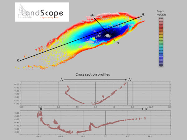
We hope the client will be happy with the detailed profile we were able to provide for them. Working at LandScope brings unexpectedly diverse and unusual adventures for our team every week, and if you would be interested in joining the fun please keep an eye on our vacancies page or get in touch with your CV.