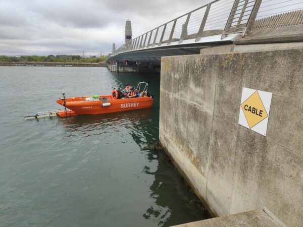
River Survey and Integrated Point Cloud Across 10km Corridor
LandScope Engineering recently completed a detailed river survey covering more than 10km of watercourse.
The project required accurate information from the riverbed, banks and surrounding corridor. This would provide the client with reliable data to support assessment, design and future management of the river environment.
The Challenge
Surveying more than 10km of river presented several practical challenges. Water depth, vegetation, restricted access and changing river conditions varied throughout the route.
The corridor also included bridges and other structures that required detailed capture. Maintaining consistent survey control across the full length was essential to ensure every dataset aligned correctly.
A single survey method would not have provided the required coverage or level of detail.
Our Approach
LandScope developed a fit-for-purpose survey methodology based on the conditions found along different sections of the river.
Our team combined hydrographic surveying with established geospatial survey techniques. The correct survey platform and equipment were selected for each environment, allowing data to be captured safely and efficiently.
All above-water and below-water data was coordinated within a common survey control framework. This created a consistent dataset across the entire river corridor.
Creating an Integrated River Point Cloud
The survey data was processed to create a detailed point cloud showing the river and its surrounding environment.
Features captured included:
- Riverbed levels and channel profiles
- Riverbanks and surrounding terrain
- Bridges and associated structures
- Areas of erosion and sediment build-up
- Debris and potential flow obstructions
- Changes in channel shape and condition
Combining multiple survey datasets provided the client with a clear and measurable representation of the river corridor.
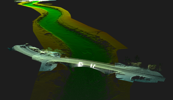
Integrated point cloud from a 10km river survey showing the river channel, banks and bridge structure
Quality Underpinned by Geospatial Principles
Accurate data capture is only one part of a successful river survey.
LandScope applied robust geospatial principles throughout the project. Survey control, sensor coordination and independent verification were used to maintain consistency across the full 10km route.
Quality assurance continued through processing and final delivery. This ensured the outputs were accurate, traceable and fit for their intended purpose.
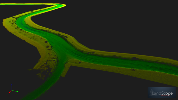
Integrated point cloud from a 10km river survey
The Outcome
The client received a coordinated survey dataset covering more than 10km of river.
The resulting point cloud and associated deliverables provide a reliable foundation for:
- Hydraulic modelling
- Flood risk assessment
- River and asset management
- Infrastructure design
- Bridge and structure assessment
- Erosion and sediment monitoring
- Future maintenance planning
By selecting appropriate technology for each section, LandScope improved coverage, managed safety risks and delivered an efficient survey programme.
Reliable Data for Better Water-Sector Decisions
This project demonstrates the value of combining hydrographic experience, fit-for-purpose equipment and sound geospatial principles.
Rather than simply collecting data, LandScope delivered a consistent and practical representation of a complex river environment. This gives the client reliable information to support informed decisions throughout the project lifecycle.
If you are planning a river, flood defence or water infrastructure survey, contact LandScope Engineering to discuss a methodology suited to your project.