Bridge Scour Survey Reveals Risk – What’s Below the Waterline
Project overview
LandScope Engineering was appointed to complete a bridge scour survey where erosion around the foundations had raised concerns about structural stability and the potential risk of collapse.
The bridge was considered unsafe, which meant vessel access beneath the structure was prohibited. A weir immediately downstream created an additional hazard and ruled out conventional inspection methods.
The challenge
The client needed reliable information about the bridge foundations and surrounding riverbed to support a structural assessment.
Key challenges included:
- Restricted access beneath the bridge
- Concerns about the stability of the structure
- A weir immediately downstream
- Strong river flow and poor underwater visibility
- The need to keep personnel away from high-risk areas
The survey method needed to capture detailed information above and below the waterline without placing the team in danger.
Our approach
LandScope developed a safe, remote survey approach suited to the site conditions.
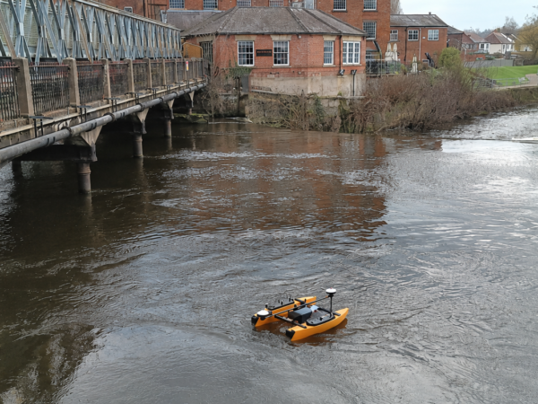
Using a remotely operated survey vessel and underwater data capture technology, the team collected detailed information around the bridge supports from a secure operating location.
This removed the need for personnel or a crewed vessel to work directly beneath the unstable structure or close to the downstream weir.
The results
The completed dataset created a detailed three-dimensional record of the bridge and surrounding river environment.
The colourised point cloud captured the bridge, visible debris and other features above the waterline. Below the surface, the submerged bridge legs and surrounding riverbed were clearly visible.
The blue areas within the data identified the lower sections of the riverbed. These showed where scour had eroded material from around the bridge supports, helping engineers understand the extent of the problem and its potential effect on the structure’s stability.
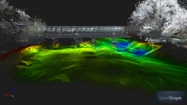
Bridge scour survey point cloud data
Client benefits
The bridge scour survey provided the client with:
- A clear view of the submerged bridge foundations
- Evidence of riverbed erosion around the supports
- Colourised data showing debris above the waterline
- Accurate information to support structural assessment
- A digital record for future monitoring and comparison
- Reduced risk to survey personnel
- Reliable data collected without entering prohibited areas
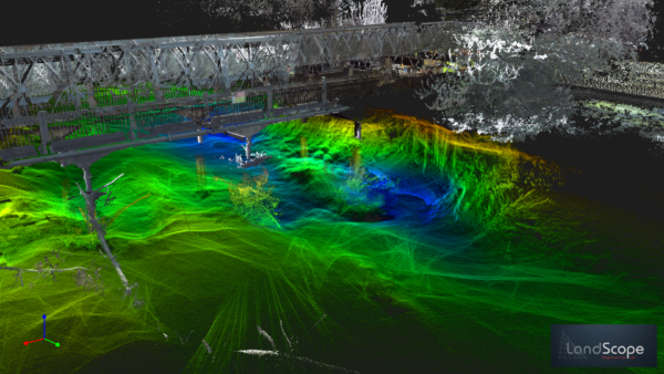
Bridge scour survey point cloud showing submerged supports and riverbed erosion
The outcome
By selecting a survey method suited to the risks and access restrictions, LandScope delivered the information required without compromising safety.
The combined above-water and underwater dataset gave engineers a clearer understanding of the bridge, surrounding riverbed and areas affected by scour. This supported informed decisions about the condition and future management of the asset.
Safe operations. Clear data. Better engineering decisions.
To discuss a bridge scour survey, hydrographic survey or underwater asset inspection, contact LandScope Engineering.