Hydrographic Survey Team in High Demand
LandScope Engineering’s hydrographic survey team continues to experience strong demand across the water, infrastructure and environmental sectors.
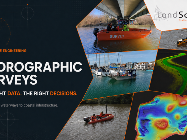
Our team works across rivers, reservoirs, ports, bridges and coastal assets. Using staffed, remote-controlled and unmanned survey vessels, we select a fit-for-purpose solution for every environment.
This flexible approach allows us to work safely in shallow water, confined locations and around potentially unstable structures. It also helps clients avoid unnecessary cost and disruption.
Survey data can be delivered as:
- Bathymetric models
- Riverbed and seabed profiles
- Point clouds and 3D visualisations
- Scour assessments
- CAD drawings and engineering outputs
These deliverables help clients understand submerged assets, identify change and make informed decisions about design, maintenance and asset management.
Whatever the environment, LandScope provides the right platform and the right data for better engineering decisions.
![river severn 4]](https://www.land-scope.com/wp-content/uploads/2026/07/river-severn-4-600x450.png)