Integrated Survey for Local Council
LandScope have recently completed an integrated Topographical, Utility Mapping and Subsurface Ground Investigation survey at a residential site on behalf of the local council.
Working in association with our approved ground investigation partner Risk Management Ltd, LandScope provided a turn-key detailed site investigation service within both time and budget constraints.
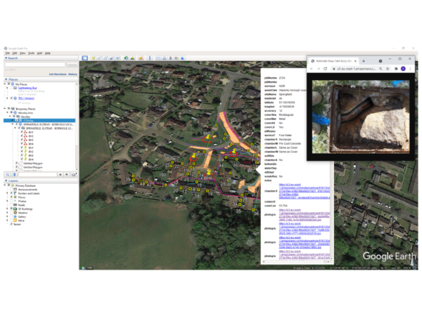
Our utility mapping teams utilised our newly developed Electronic Underground Feature Record (EUFR) app for the recording of manhole and inspection chamber information on this project. This data was made available to our Client via Google Earth where they simply click on an asset to reveal the associated metadata and imagery (see image below).
Have a read of our blog post about the EUFR app and the efficiencies it offers to our fieldwork workflows: Increasing Efficiency on Site
If you would like more information on any of our survey solutions please contact our commercial team on 01694 731930 or enquiries@land-scope.com