UNDERGROUND UTILITY
SURVEY
Underground utility surveys are vital in ensuring the safety and efficiency of a variety of infrastructure and construction projects. Prior to any excavation works, mapping the sub-surface environment is a critical process that provides our clients with crucial information regarding the geographic location of utilities and other underground features. Our buried services surveys employ a range of methods, all undertaken by our experienced in-house team of utility surveyors.
UNDERGROUND UTILITY SURVEYS
A critical component in the design, engineering, and safe completion of infrastructure projects. Prior to feasibility, design and excavation works, underground utility detection is considered a critical process. High-quality subsurface data provides our clients with crucial information regarding the geographic location of utilities and other underground features. LandScope’s innovation and advances in sub-surface mapping technology, combined with the highest order of surveyor diligence, ensure unprecedented levels of technical certainty in the accuracy of sub-surface infrastructure mapping and detection.
BENEFITS OF UNDERGROUND UTILITY MAPPING
Aside from significantly reducing the risk of utility strikes, and the potential impact of this on the workforce and general public, underground surveying provides a host of additional benefits, including:
- Minimising disruption and project delays
- Reducing project cost and overall risk
- Enhancing health and safety – ensuring a safe working environment
- Reducing the need for invasive/intrusive underground inspections or investigations
- Providing accurate, up to date records
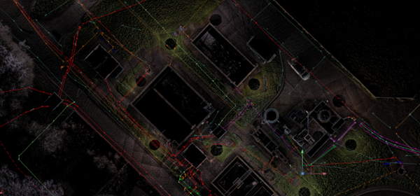
BURIED SURVEY TECHNIQUES
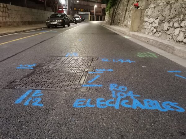
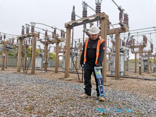
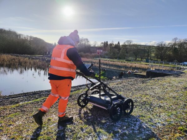
To produce a concise and accurate underground utility mapping survey, we utilise as standard both electromagnetic location (EML) and ground penetrating radar (GPR) surveying methods. Other geophysical sensors are integrated to the solution design as required. Additionally, all manholes, inspection chambers and other associated infrastructure are lifted and documented using our EUFR platform.
Data can be delivered in a variety of formats including 2D/3D CAD drawings or GIS outputs and can include georeferenced manhole information and photography from our EUFR reporting.
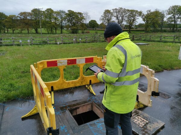
ELECTRONIC UNDERGROUND FEATURE RECORD (EUFR)
Our teams digitally record inspection chamber and manhole information directly into our innovative EUFR app whilst in the field. In addition to standard photography, the app collects 360º downhole images, reducing the need to re-lift or re-survey manholes in the future.
All data is automatically saved and uploaded directly to the cloud meaning the office team have access to the information as soon as it is captured in the field. Using data from the EUFR, we can produce in-depth reports with a single click or export them into a GIS package such as QGIS or ArcGIS for visualisation of above and below ground survey data in one cloud-based platform.
DELIVERY
LandScope strive to be at the forefront of the survey industry. This is not just reflected in our personnel and equipment – we also work with our customers to find better, more efficient ways of sharing data that is accessible to all. Many industry specifications were written prior to the recent technical advancements in equipment and software. Much of the high value 3D data we collect is essentially oversimplified and reduced to basic / crude levels to meet outdated workflows.
LandScope is committed to work with its customer base to ensure you receive maximum value and access to all data. Delivery ranges from standard linework drawings to 3D models and bespoke solutions.