LandScope Supports 5km Sewer Pipeline Project with Integrated Survey Solution
LandScope Supports 5km Sewer Pipeline Project with Integrated Survey Solution
A major UK water company recently appointed LandScope to deliver an integrated survey solution for a proposed 5km sewer pipeline.
The project required accurate geospatial data to support route planning, detailed design and future construction. However, the survey corridor presented a range of technical and logistical challenges.
The route crossed busy highways, farmland, active construction sites, overhead powerlines and multiple river crossings. As a result, no single survey method could deliver the safest or most efficient solution.
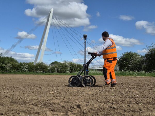
A Fit-for-Purpose Survey Strategy
LandScope combined several survey technologies to capture accurate data across the entire corridor.
The integrated approach included:
- UAV LiDAR for rapid topographical surveys
- PAS128 utility surveying using GPR and EML
- Mobile mapping for highway environments
By selecting the right technology for each location, our team improved safety, reduced disruption and delivered one coordinated geospatial dataset.
Integrated Topographical, PAS128 Utility Survey, UAV LiDAR & Mobile Mapping
Supporting Better Design Decisions
The completed survey package included topographical data, PAS128 utility information, CAD drawings, point clouds and GIS-ready datasets.
These deliverables gave engineers and designers a trusted source of information to support route selection, identify utility constraints and reduce project risk before construction.
Read the Full Case Study
This project highlights how integrated survey solutions can improve safety, increase efficiency and provide the reliable data needed for complex infrastructure projects.
Read the Full Case Study here, to learn how LandScope delivered a comprehensive survey solution for this 5km sewer pipeline project.