Why Mobile Mapping and Mobile GPR Are Transforming Highway Infrastructure Surveys
Mobile Mapping and Mobile GPR: Rethinking Utility Route Planning in Busy Urban Highways
How integrated survey technology is helping designers reduce risk, minimise disruption and make better infrastructure decisions before construction begins.
Designing new infrastructure in busy urban environments has never been more challenging.
With congested highways, increasing utility congestion, tighter budgets and greater expectations around sustainability, understanding existing conditions before construction begins is becoming increasingly important.
Traditional survey methods often require multiple site visits, extensive traffic management and separate survey packages to build a complete picture of the existing environment. This can add unnecessary cost, programme delays and uncertainty long before construction starts.
At LandScope Engineering, we believe there’s a better way.
By combining Mobile Mapping with Mobile Ground Penetrating Radar (Mobile GPR), project teams can capture accurate information above and below ground during a single integrated survey programme.
The result is a comprehensive digital representation of the highway corridor that allows engineers and designers to make better decisions earlier in the project lifecycle.
One Survey. One Trusted Dataset.
Rather than commissioning separate topographical and utility surveys, integrated mobile survey technology provides a coordinated understanding of the existing environment.
This approach helps project teams:
- Improve route selection
- Reduce uncertainty around buried utilities
- Minimise unnecessary utility diversions
- Reduce design iterations
- Improve cost certainty
- Support safer delivery
- Reduce disruption to the travelling public
With survey-grade point cloud data aligned with underground utility information, designers gain a clearer understanding of existing constraints before construction begins.
Reducing Traffic Management Through Innovation
One of the biggest advantages of mobile survey technology is its ability to reduce or even eliminate traditional traffic management requirements.
Vehicle-mounted Mobile Mapping and Mobile GPR systems can safely collect large volumes of survey data while remaining within the live highway environment.
Where appropriate, this can significantly reduce:
- Lane closures
- Temporary traffic management costs
- Workforce exposure to live traffic
- Carbon associated with prolonged site occupation
- Programme duration
For clients, that means safer surveys, lower costs and faster project delivery.
A Recent Example
LandScope recently completed an integrated Mobile Mapping and Mobile GPR survey across more than 9km of busy London highway, capturing comprehensive above and below ground information during overnight operations.
Using mobile survey technology, the project was completed without conventional traffic management, while providing designers with the information needed to identify the preferred route for a proposed service installation.
The integrated dataset helped improve confidence during design by providing accurate topographical information alongside underground utility data, reducing uncertainty before construction commenced.
Read the full case study here: Mobile Mapping & Mobile GPR Survey Across 9km of Busy London Highway.
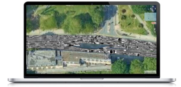
GPR data
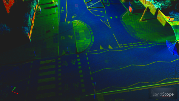
Point cloud data highlighting level of detail captured
Looking Ahead
As infrastructure projects become increasingly complex, integrated survey solutions will continue to play an important role in reducing risk and improving project outcomes.
By combining multiple technologies within a single mobilisation, project teams gain access to richer, more reliable information that supports better decisions throughout planning, design and delivery.
For organisations looking to reduce programme, improve safety and make more informed engineering decisions, integrated geospatial data is becoming an essential part of modern infrastructure delivery.